

92-DAY AFRICA TOP 2 BOTTOM EXPEDITION

$39,999RIDER ON OWN BIKE, IN A SHARED ROOM
Last updated: September 12, 2026
RIDING MIX
20%OFF-ROAD
60%COMFORT
100%FUN

NEXT TOUR DATES
» JAN 6 – APR 6, 2028

ALL YOU NEED TO KNOW ABOUT THE 92-DAY AFRICA TOP 2 BOTTOM EXPEDITION

In 2028, MotoDreamer celebrates 20 years of motorcycle adventures with our biggest undertaking yet: a 92-day overland expedition from Málaga to Cape Town. Starting in southern Spain, we cross into Morocco and ride the length of western Africa through the Sahara, tropical West Africa, Central Africa, Angola, Namibia and finally South Africa.

READ MOREREAD LESS+–

This is not a conventional motorcycle tour. It is a true transcontinental expedition, covering roughly 17,000 kilometres through more than a dozen countries, major border crossings, remote regions, deserts, jungles and some of Africa’s most remarkable cultural and natural highlights. Supported by two 4x4 vehicles and extensive local coordination, the route is designed to stay on pavement wherever possible while keeping the journey efficient, realistic and adventurous.

Twenty years of MotoDreamer has led to this. This is the first Africa Top 2 Bottom Expedition with a group, but Mike has previously travelled extensively in over half of the destinations on the route already. Expect a true adventure in every way led by a very experienced team!

Your 92-day Africa Top 2 Bottom Expedition passes through 17 countries: Spain, Morocco, Mauritania, Senegal, Guinea, Côte d'Ivoire, Ghana, Togo, Benin, Nigeria, Cameroon, Gabon, Republic of Congo, DR Congo, Angola, Namibia and South Africa.

BRING YOUR OWN BIKE OR RENT ONE FROM US – OBS: ONE-WAY!
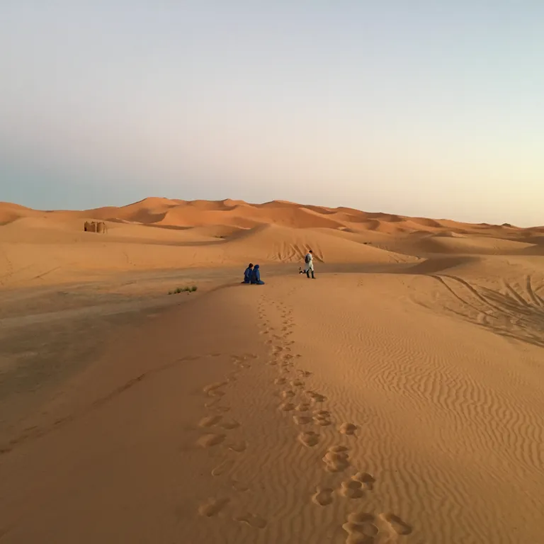
Sahara Crossing

POI: SAHARA CROSSING

Ride south from Morocco through Western Sahara and Mauritania on seemingly endless roads between desert and Atlantic Ocean. It is one of the expedition’s defining landscapes and the gateway into West Africa.
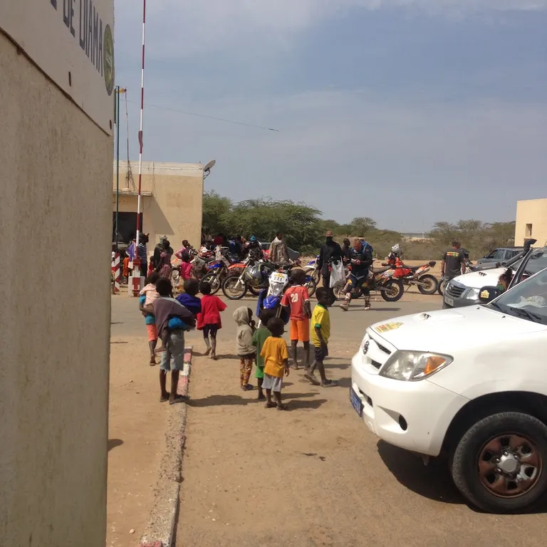
West Africa

POI: WEST AFRICA

Experience the changing cultures, history and scenery of Senegal, Guinea, Côte d’Ivoire, Ghana, Togo and Benin. From colonial forts and bustling capitals to mountain roads and tropical forests, every border brings a completely different Africa.
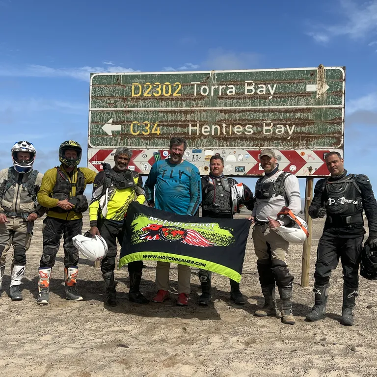
Cape Finish

POI: CAPE FINISH

After Angola and the vast landscapes of Namibia, the expedition turns south for its final run into South Africa. Reaching Cape Town after more than 17,000 kilometres will mark the finish of MotoDreamer’s biggest journey in 20 years.

TOUR ITINERARY

DAY 1 – ARRIVAL TO MÁLAGA, SPAIN – 0 KM

EXPANDCLOSE+–

Arrival day for riders, motorcycles and support vehicles, with the entire convoy assembled in Málaga. Use the day for introductions, paperwork checks, bike preparation and the expedition briefing:
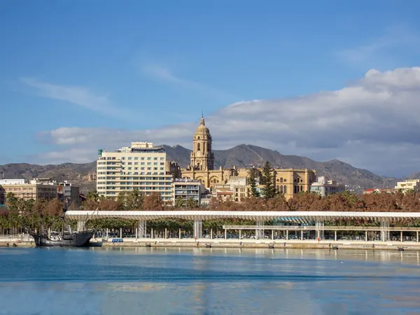
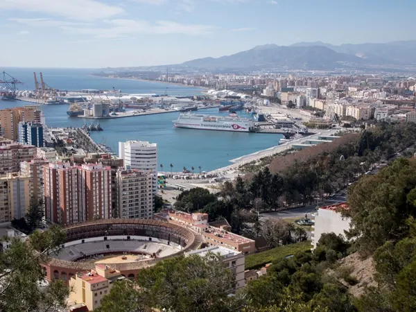
Málaga, port and cathedralMálaga, port and bullring from Gibralfaro

DAY 2 – TANGIER, MOROCCO – 150 KM

EXPANDCLOSE+–

Ride to the Strait of Gibraltar and cross by ferry into Morocco for the official start of the African section. Allow plenty of time for Moroccan immigration and temporary vehicle-import formalities before heading to the hotel.
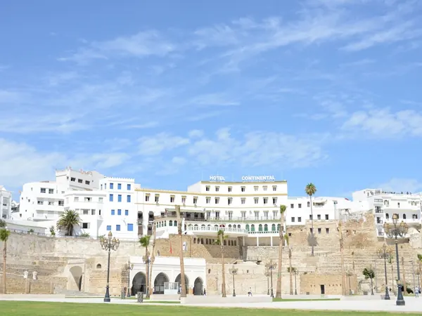
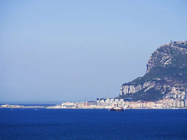
Tangier, medina walls above the portStrait of Gibraltar, the Rock seen from the sea

DAY 3 – CASABLANCA, MOROCCO – 340 KM

EXPANDCLOSE+–

Follow the fast Atlantic corridor south, making this a straightforward introduction to riding in Morocco. Casablanca gives us the Hassan II Mosque and the famous Bogart connection without taking us away from the southbound route.
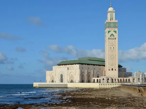
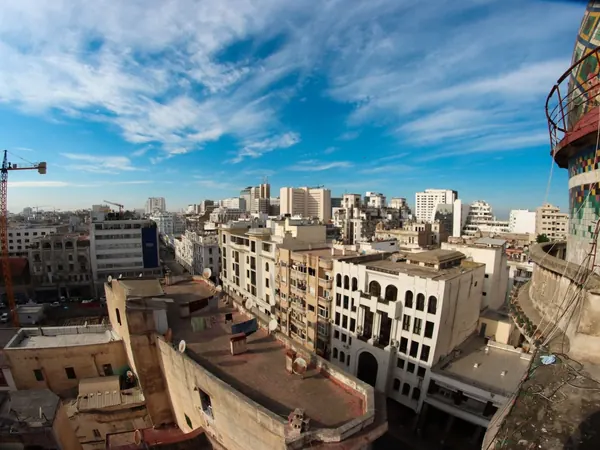
Casablanca, Hassan II Mosque on the AtlanticCasablanca, city centre rooftops

DAY 4 – MARRAKECH, MOROCCO – 240 KM

EXPANDCLOSE+–

A relatively short paved ride brings the convoy inland to one of Morocco's essential destinations. Arriving early allows time to explore Jemaa el-Fnaa and the old medina.
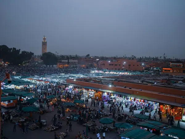
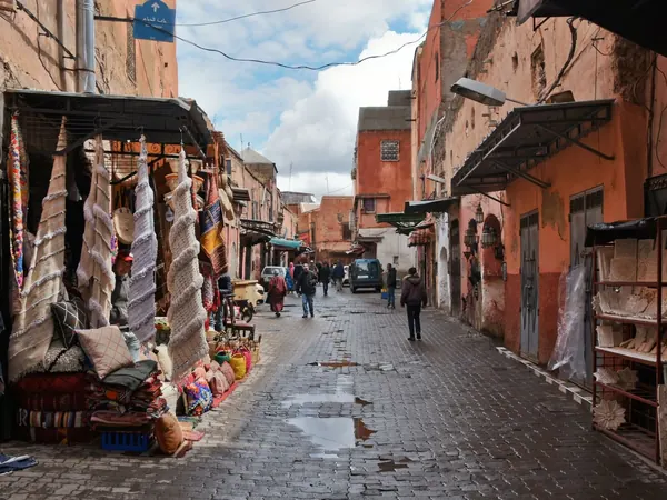
Marrakech, Jemaa el-Fnaa at dusk with the KoutoubiaMarrakech, street in the old medina

DAY 5 – REST DAY IN MARRAKECH, MOROCCO – 0 KM

EXPANDCLOSE+–

Full rest and sightseeing day in Marrakech. The support team can simultaneously inspect motorcycles and vehicles before the long run into the Sahara.
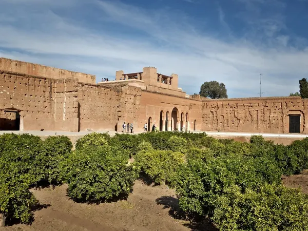
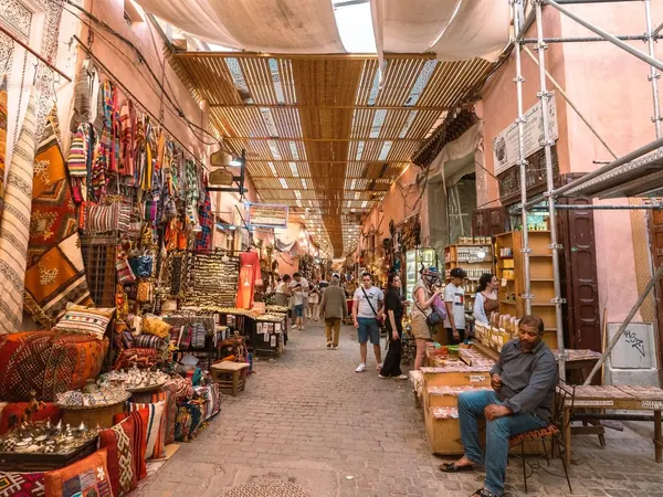
Marrakech, El Badi PalaceMarrakech, souk in the medina

DAY 6 – AGADIR, MOROCCO – 250 KM

EXPANDCLOSE+–

Cross toward the Atlantic and descend to Agadir on good paved roads. This positions us perfectly for the long coastal run through southern Morocco and Western Sahara.
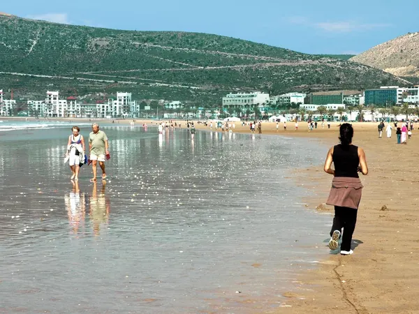
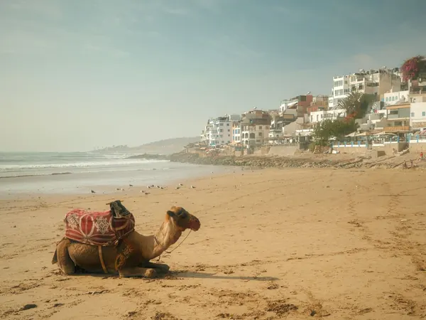
Agadir, the beach and Kasbah hillAtlantic coast near Agadir, camel on the beach

DAY 7 – TAN-TAN, MOROCCO – 330 KM

EXPANDCLOSE+–

Continue south along the Atlantic through increasingly barren landscapes. Tan-Tan provides a practical secure overnight before entering the much longer desert stages.
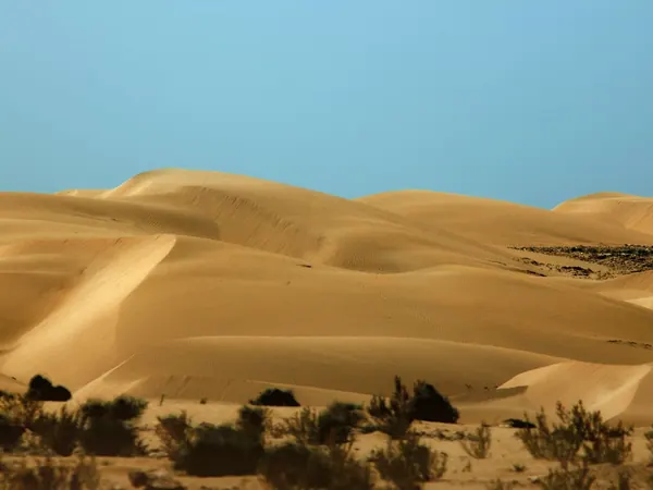
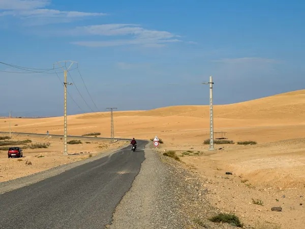
Sand dunes near Tan-TanDesert road through the dunes of southern Morocco

DAY 8 – LAÂYOUNE, MOROCCO – 330 KM

EXPANDCLOSE+–

Follow the main N1 south across the desert on predominantly excellent pavement. The riding becomes increasingly remote, but fuel and services remain available along this major transport corridor.
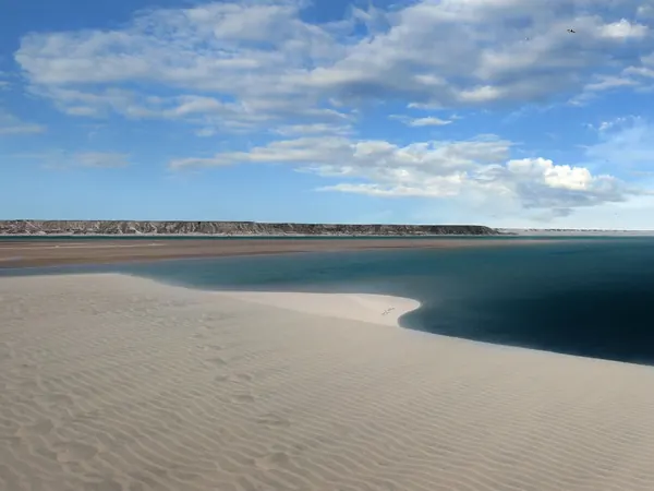
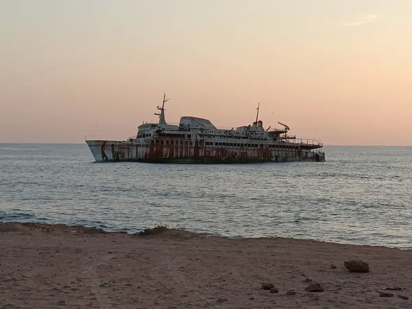
Tidal dunes and lagoon, Laâyoune-Sakia El Hamra regionShipwreck off the Tarfaya coast, on the N1 towards Laâyoune

DAY 9 – DAKHLA, MOROCCO – 530 KM

EXPANDCLOSE+–

This is one of the longer riding days, almost entirely on the paved N1 through Western Sahara. The dramatic desert-and-ocean landscapes make the distance worthwhile, with Dakhla providing an excellent two-night stop.
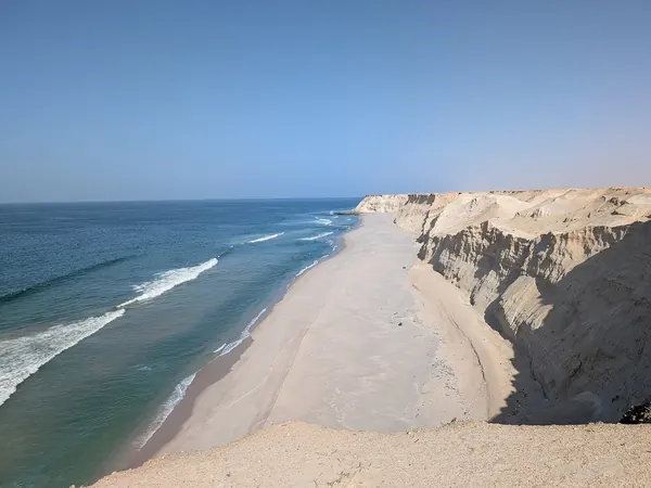
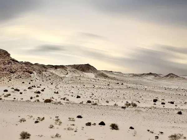
Desert cliffs and Atlantic beach near DakhlaDesert landscape of the Dakhla peninsula, Western Sahara

DAY 10 – REST DAY IN DAKHLA, MOROCCO – 0 KM

EXPANDCLOSE+–

A full rest and maintenance day before the Mauritanian section. Use it for tyres, chains, fluids, supplies and final preparation of the complete vehicle-document package.
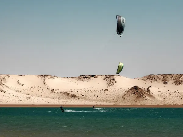
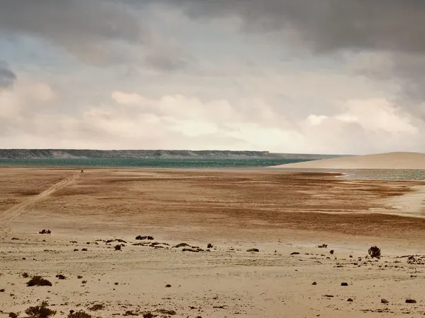
Dakhla lagoon with kitesurfersDakhla, desert shore of the lagoon

DAY 11 – BIR GANDOUZ, MOROCCO – 350 KM

EXPANDCLOSE+–

Continue south to the final practical overnight before the Mauritanian frontier. The short positioning strategy allows us to attack the border early the following morning.
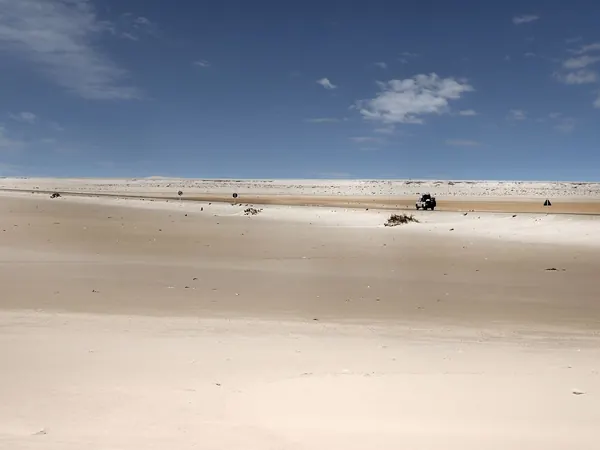
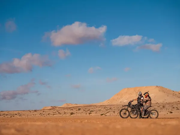
Flat Saharan desert along the N1 south of DakhlaMotorcycles in the desert near Dakhla, Western Sahara

DAY 12 – NOUADHIBOU, MAURITANIA – 160 KM

EXPANDCLOSE+–

Cross at Guerguerat and complete Moroccan exit and Mauritanian immigration, customs and vehicle formalities. The short mileage is deliberate because the border procedures for 13 motorcycles and two 4x4s could consume much of the day.
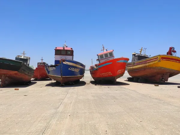
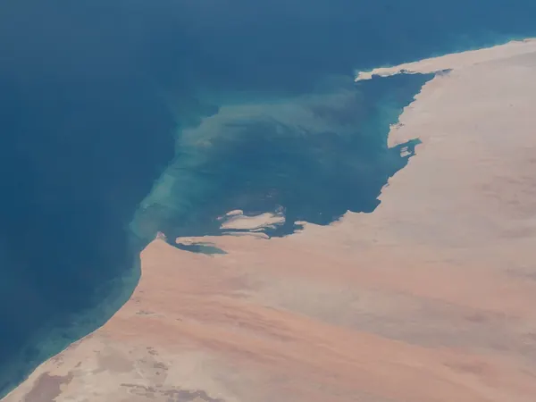
Nouadhibou, fishing boats in the portCap Blanc peninsula (Nouadhibou) and the Western Sahara–Mauritania border coast from the ISS

DAY 13 – NOUAKCHOTT, MAURITANIA – 470 KM

EXPANDCLOSE+–

Ride the long paved desert highway south between the Atlantic and the Sahara. This is a remote but relatively simple transit day with fuel strategy and convoy discipline important.
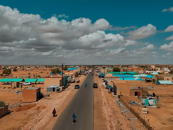
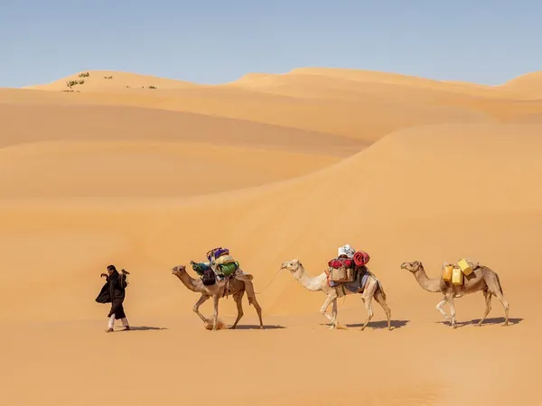
Paved highway through a Mauritanian desert townCamel caravan in the Mauritanian Sahara (Amatlich erg)

DAY 14 – REST DAY IN NOUAKCHOTT, MAURITANIA – 0 KM

EXPANDCLOSE+–

Rest, administration and vehicle-service day in the Mauritanian capital. It also provides an early buffer if the Guerguerat crossing took longer than expected.
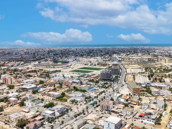
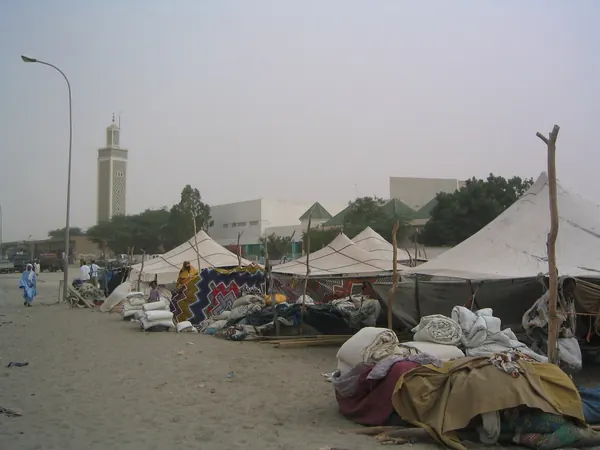
Nouakchott from above, towards the AtlanticNouakchott, Moroccan mosque and tent market

DAY 15 – SAINT-LOUIS, SENEGAL – 300 KM

EXPANDCLOSE+–

Continue south and cross from Mauritania into Senegal, ideally using the most efficient operational border available at the time. Saint-Louis provides an attractive historical overnight immediately after another potentially lengthy frontier.
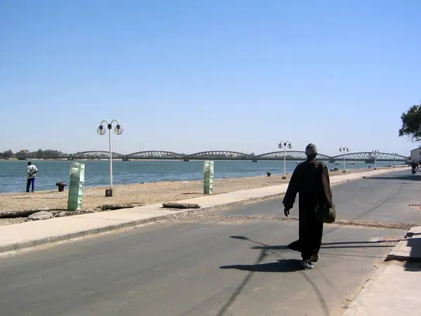
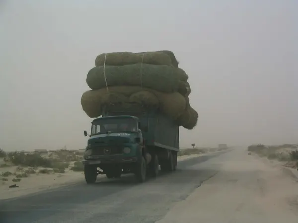
Saint-Louis, Faidherbe Bridge over the Senegal RiverPaved road Nouakchott–Rosso towards the Senegal border

DAY 16 – DJOUDJ BIRD SANCTUARY, SAINT-LOUIS, SENEGAL – 130 KM

EXPANDCLOSE+–

CONTINGENCY. If the expedition is on schedule, use the day for the wetlands and wildlife of Djoudj. If earlier borders have delayed us, this excursion disappears and the day becomes schedule recovery.
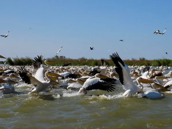
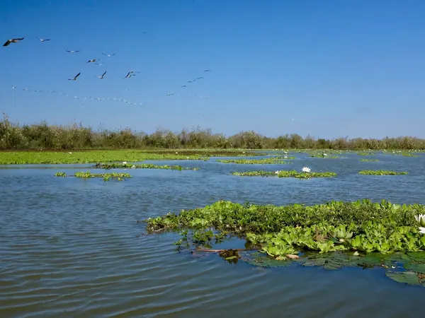
Djoudj National Bird Sanctuary, great white pelicansDjoudj National Bird Sanctuary, wetlands and water lilies

DAY 17 – DAKAR, SENEGAL – 260 KM

EXPANDCLOSE+–

Follow the main paved road south toward Senegal's capital. Dakar is one of the major cultural stops of the expedition and also offers excellent logistical support.
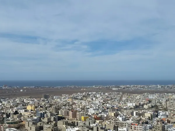
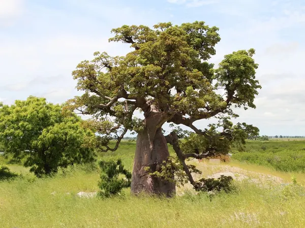
Dakar, city view towards the AtlanticBaobab in the Senegalese bush on the road to Dakar

DAY 18 – REST DAY IN DAKAR, SENEGAL – 0 KM

EXPANDCLOSE+–

Full sightseeing and rest day with the option to visit Gorée Island. The support crew can perform another mechanical inspection while riders take a genuine break.
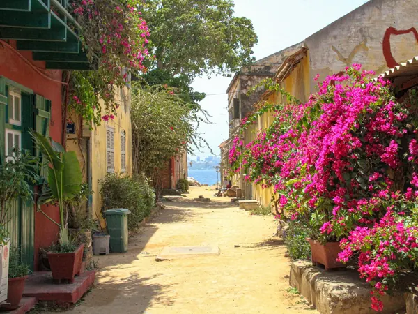
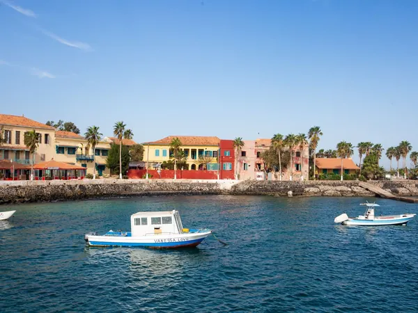
Gorée Island (Dakar), colorful laneGorée Island waterfront, off Dakar

DAY 19 – TAMBACOUNDA, SENEGAL – 470 KM

EXPANDCLOSE+–

Turn inland and ride east across Senegal rather than adding unnecessary borders through Gambia. This is a long but efficient paved transit that positions us for Guinea.
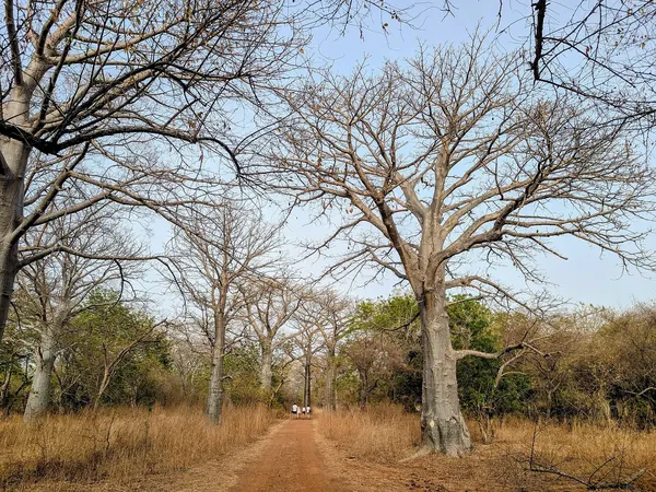
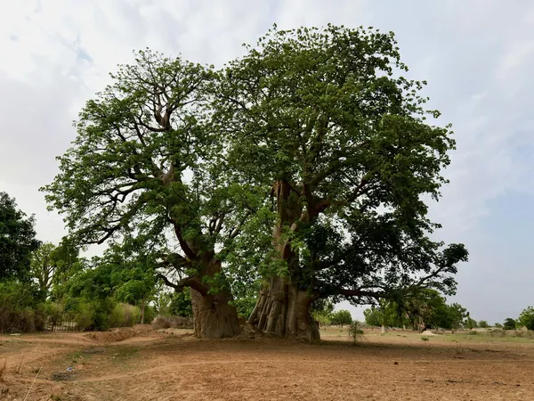
Baobab forest in the Sine-Saloum / Kaolack region, on the road east to TambacoundaTwin baobab in the Senegalese savannah, eastern Senegal

DAY 20 – KOUNDARA, GUINEA – 300 KM

EXPANDCLOSE+–

Cross into Guinea and continue to Koundara. The relatively modest mileage provides sufficient time for another full convoy border procedure.
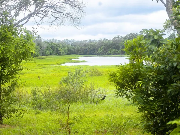
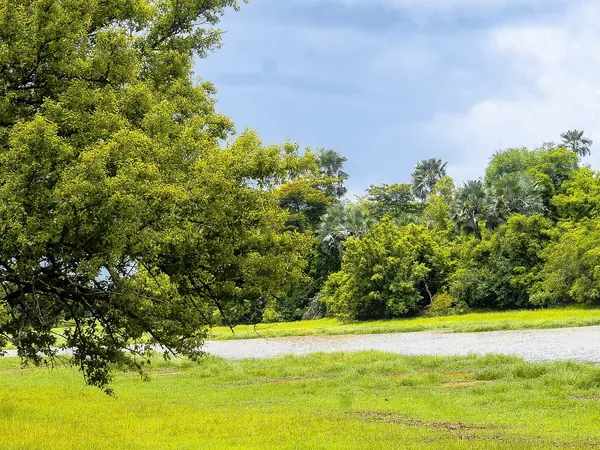
Niokolo-Koba National Park, the Senegal–Guinea border region on the way to KoundaraGambia River valley in Niokolo-Koba, towards the Guinean frontier

DAY 21 – LABÉ, GUINEA – 250 KM

EXPANDCLOSE+–

Climb into the Fouta Djallon highlands on increasingly interesting roads. Labé becomes our base for both rest and exploration of one of Guinea's most scenic regions.
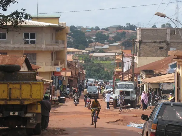
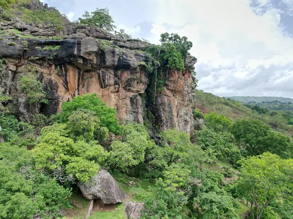
Labé, main street in the town centreFouta Djallon highlands near Labé (Lélouma cliffs)

DAY 22 – REST DAY IN LABÉ, GUINEA – 0 KM

EXPANDCLOSE+–

Rest day after the first demanding West African road stages. It is also useful for checking current road intelligence before continuing toward southeastern Guinea.
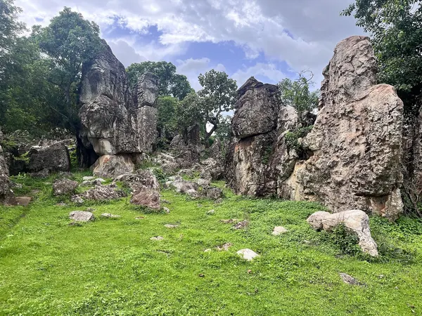
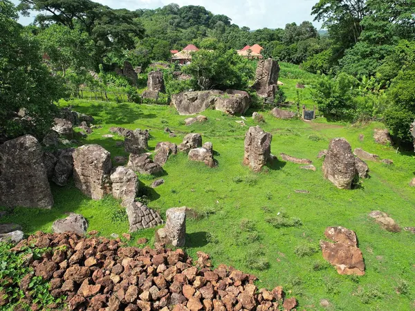
Rock formations in the Fouta Djallon, Labé region (Lélouma)Highland village among rocks and green pastures, Labé region

DAY 23 – FOUTA DJALLON EXCURSION, LABÉ, GUINEA – 150 KM

EXPANDCLOSE+–

CONTINGENCY. If everything is running correctly, spend the day exploring waterfalls, highland scenery and local villages. The entire excursion can be cancelled if we need to recover a lost day.
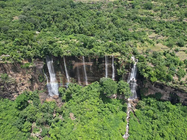
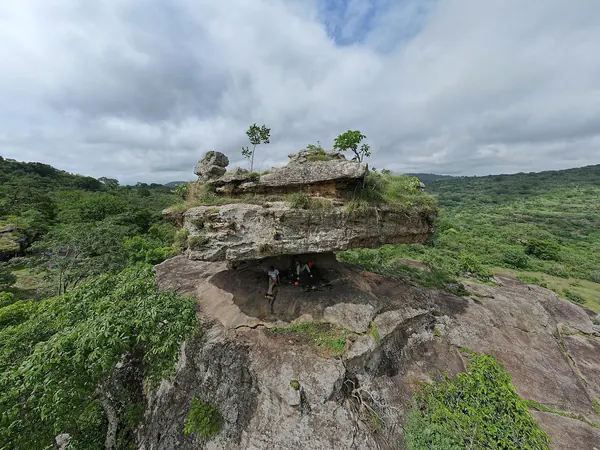
Fouta Djallon waterfalls (Chute de Lélouma)Tounty balancing rock, Fouta Djallon highlands (Lélouma)

DAY 24 – MAMOU, GUINEA – 150 KM

EXPANDCLOSE+–

A short southbound stage through Guinea's central highlands. The deliberately light mileage allows the group and support crew to stay fresh before several consecutive riding days.
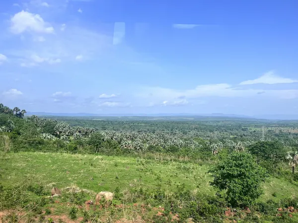
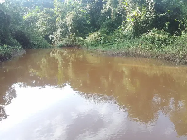
Countryside around Mamou, central Guinea highlandsBafing River at Mamou

DAY 25 – FARANAH, GUINEA – 280 KM

EXPANDCLOSE+–

Continue southeast through Guinea on the principal inland route. Road quality can vary substantially, so the relatively conservative mileage is intentional.
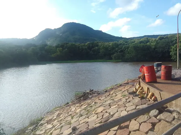
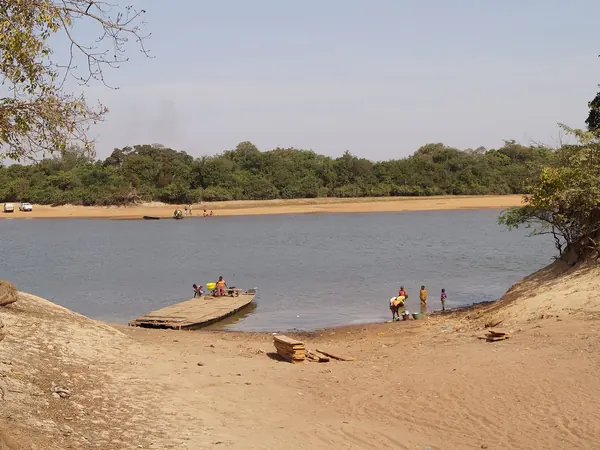
Tinkisso reservoir near Dabola, on the inland route to FaranahThe Niger River in Upper Guinea (Sangbarala)

DAY 26 – KISSIDOUGOU, GUINEA – 150 KM

EXPANDCLOSE+–

Another shorter positioning day deeper into southeastern Guinea. This allows extra time for fuel, checkpoints and unpredictable road conditions without forcing night riding.
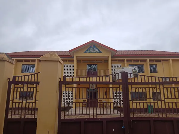
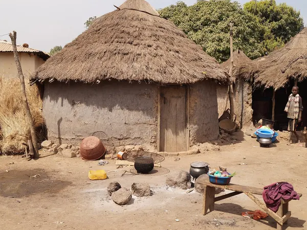
Kissidougou, prefecture buildingTraditional thatched village in Upper Guinea

DAY 27 – NZÉRÉKORÉ, GUINEA – 280 KM

EXPANDCLOSE+–

Ride south through increasingly tropical countryside toward Guinea's forest region. Nzérékoré is the logical staging point before the more questionable road toward Côte d'Ivoire.
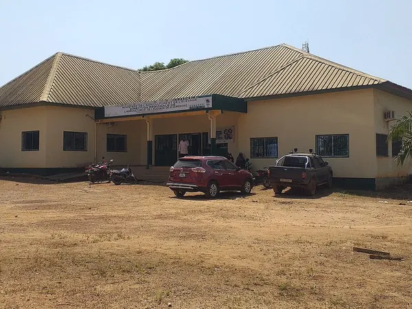
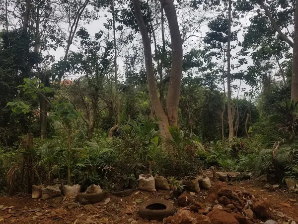
Nzérékoré, agricultural houseTropical forest zone of southeastern Guinea (forest nursery)

DAY 28 – REST DAY IN NZÉRÉKORÉ, GUINEA – 0 KM

EXPANDCLOSE+–

Rest day and, importantly, a road-intelligence day before attempting the Guinea–Côte d'Ivoire connection. Local information on rain, bridges and surface conditions should determine the following day's exact departure plan.
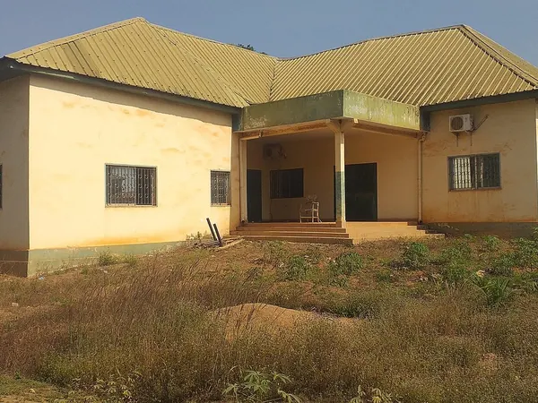
Nzérékoré, agricultural house and surroundings

DAY 29 – MAN, CÔTE D'IVOIRE – 280 KM

EXPANDCLOSE+–

Cross into Côte d'Ivoire via the southeastern Guinea corridor, one of the route's potentially rougher sections. Once across, road conditions improve and Man offers a comfortable base beneath the surrounding mountains.
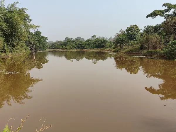
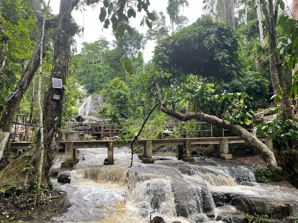
Lake Dakouigouiné in the Tonkpi mountains near ManMan cascade and footbridge in the forest, Tonkpi region

DAY 30 – REST DAY IN MAN, CÔTE D'IVOIRE – 0 KM

EXPANDCLOSE+–

Rest and sightseeing around the mountains, waterfalls and distinctive landscape of western Côte d'Ivoire. It also provides mechanical recovery after the poorer Guinea roads.
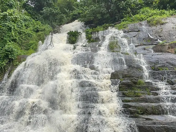
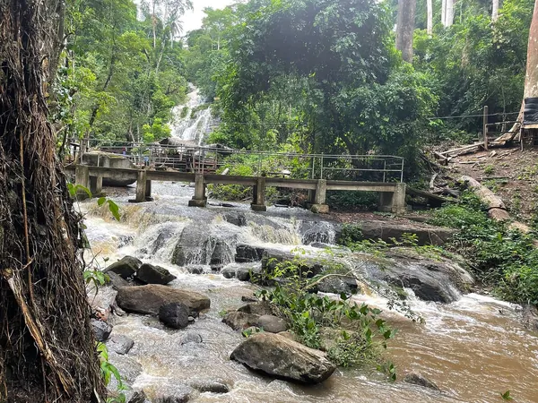
La Cascade waterfall near ManRapids below the Man cascade, western Côte d'Ivoire

DAY 31 – YAMOUSSOUKRO, CÔTE D'IVOIRE – 330 KM

EXPANDCLOSE+–

Return to better pavement and ride southeast toward the Ivorian capital. The Basilica of Our Lady of Peace provides one of the day's standout sights.
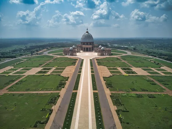
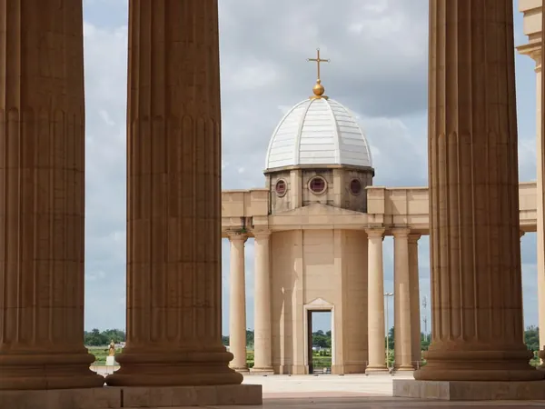
Yamoussoukro, Basilica of Our Lady of Peace from aboveYamoussoukro, basilica dome framed by the colonnade

DAY 32 – GRAND-BASSAM, CÔTE D'IVOIRE – 250 KM

EXPANDCLOSE+–

Continue toward the Atlantic and the historic colonial town of Grand-Bassam. This gives the expedition a relaxed coastal overnight after the inland crossing.
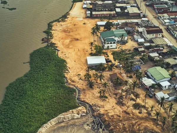
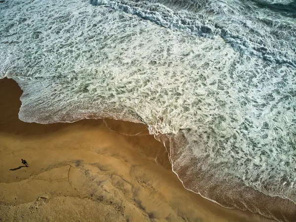
Grand-Bassam from above, between the lagoon and the seaAtlantic surf on Azuretti beach, Grand-Bassam

DAY 33 – ABIDJAN DAY TRIP, GRAND-BASSAM, CÔTE D'IVOIRE – 80 KM

EXPANDCLOSE+–

Use the short day to visit Abidjan and handle any servicing or supplies requiring a major city. Return to the quieter Grand-Bassam area for the overnight.
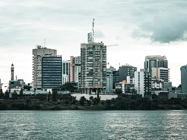
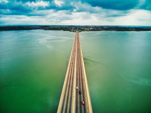
Abidjan, the Plateau skyline across the Ébrié lagoonAbidjan, bridge across the Ébrié lagoon

DAY 34 – CAPE COAST, GHANA – 300 KM

EXPANDCLOSE+–

Cross into Ghana and follow the coast east toward Cape Coast. The destination introduces one of the most important historical sections of the expedition.
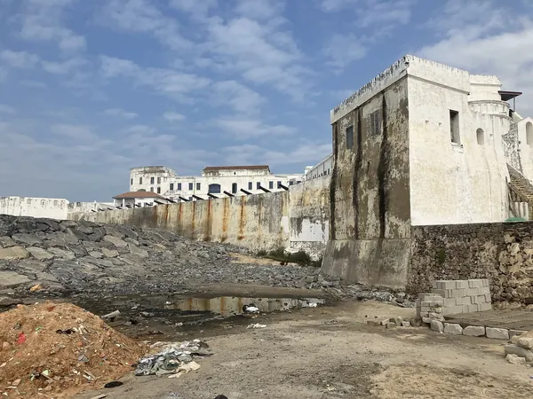
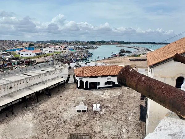
Cape Coast Castle from the shoreCape Coast town and harbour from the castle ramparts

DAY 35 – REST DAY IN CAPE COAST, GHANA – 0 KM

EXPANDCLOSE+–

Visit Cape Coast Castle, Elmina and, if desired, Kakum National Park. This is a major historical day dealing directly with the Atlantic slave trade and European colonial presence.
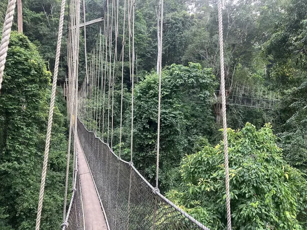
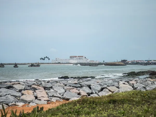
Kakum National Park canopy walkwayElmina Castle (St. George's) across the bay

DAY 36 – ACCRA, GHANA – 150 KM

EXPANDCLOSE+–

A relatively easy coastal ride brings us to Ghana's capital. Arriving early gives time for supplies, laundry and city exploration.
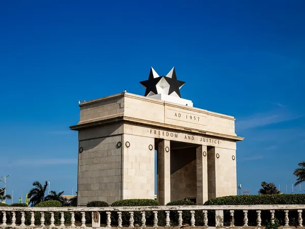
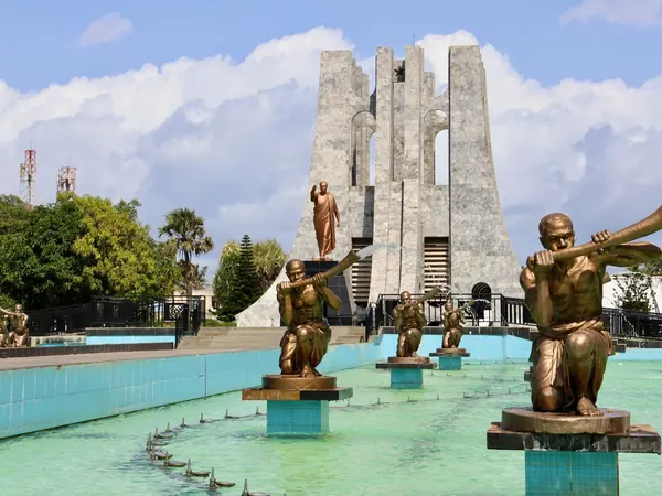
Accra, Independence Arch (Black Star Gate)Accra, Kwame Nkrumah Mausoleum

DAY 37 – REST DAY IN ACCRA, GHANA – 0 KM

EXPANDCLOSE+–

Rest and sightseeing day in Accra, including Christiansborg/Osu and its Danish colonial history. This is also a useful administrative stop before continuing toward Togo and Benin.
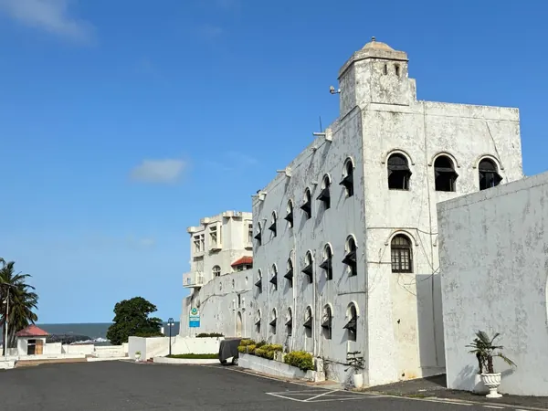
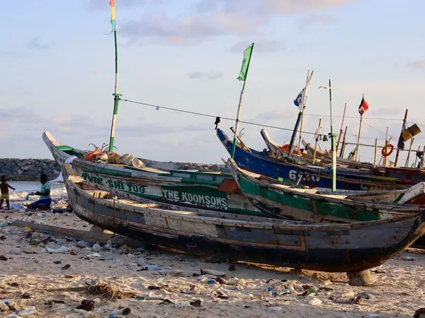
Accra, Osu Castle (Danish Christiansborg)Accra, fishing canoes on the Jamestown beach

DAY 38 – ADA FOAH & KETA, DANISH GOLD COAST FORTS, GHANA – 160 KM

EXPANDCLOSE+–

CONTINGENCY. Follow the former Danish Gold Coast east, incorporating Danish colonial sites such as the areas around Ada and Keta. If the schedule has slipped, this historical touring day can be reduced or eliminated.
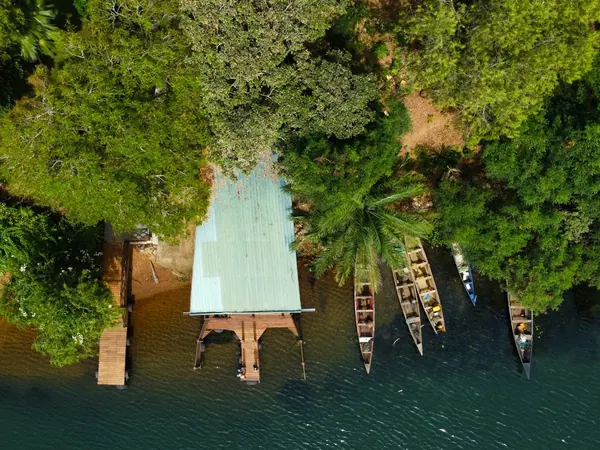
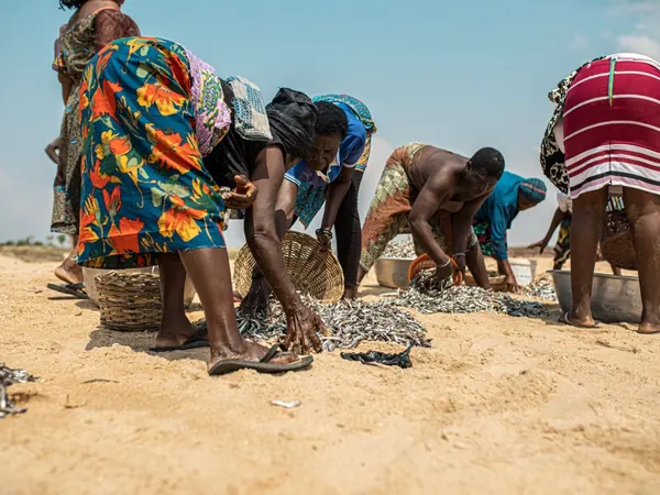
Canoes on a riverbank in Ghana (illustrative for the Volta estuary at Ada Foah)Fish harvest on Keta beach, Volta Region

DAY 39 – LOMÉ, TOGO – 150 KM

EXPANDCLOSE+–

Continue east and cross the relatively short border into Togo. Lomé offers a comfortable overnight and good facilities after several consecutive countries.
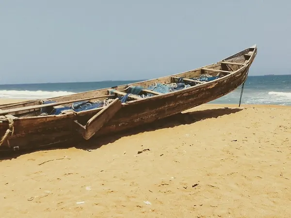
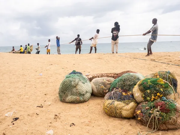
Fishing canoe on the Togolese beach near LoméFishermen hauling a beach seine on the Togo coast

DAY 40 – REST DAY IN LOMÉ, TOGO – 0 KM

EXPANDCLOSE+–

Rest and maintenance day in the Togolese capital. It is a convenient place to prepare the paperwork for Benin and, more importantly, Nigeria.
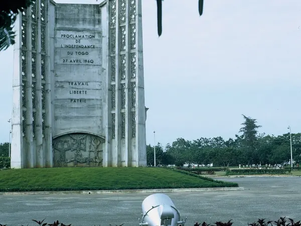
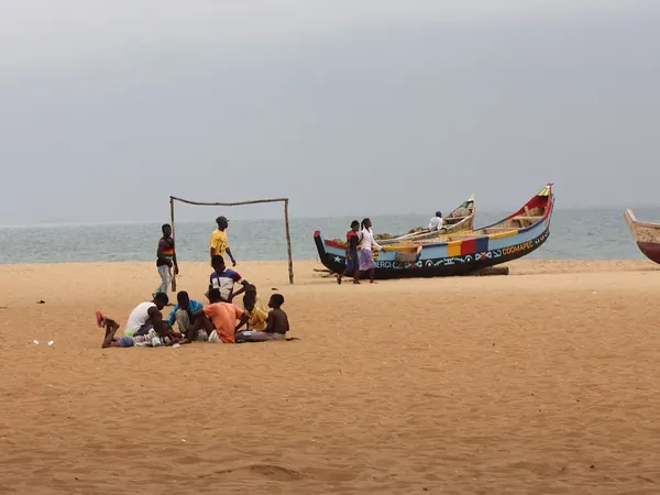
Lomé, Independence MonumentPainted pirogues on the beach in Togo

DAY 41 – COTONOU, BENIN – 170 KM

EXPANDCLOSE+–

Cross into Benin and follow the coast through Ouidah, with its major slave-route and Vodun history. Continue to Cotonou for the overnight.
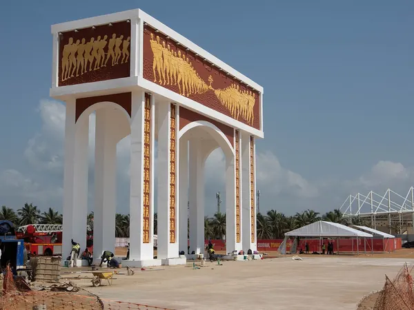
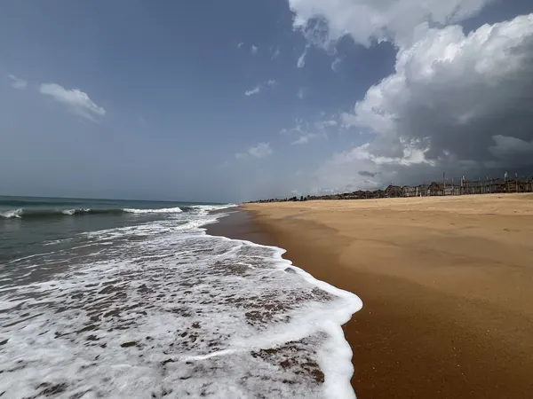
Ouidah, Door of No Return on the Slave RouteCotonou, Fidjrossè beach

DAY 42 – GANVIÉ STILT VILLAGE, COTONOU, BENIN – 0 KM

EXPANDCLOSE+–

Use local transport and boats to visit the remarkable stilt settlement of Ganvié. The motorcycles remain secure while the support team prepares for the Nigerian entry.
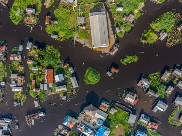
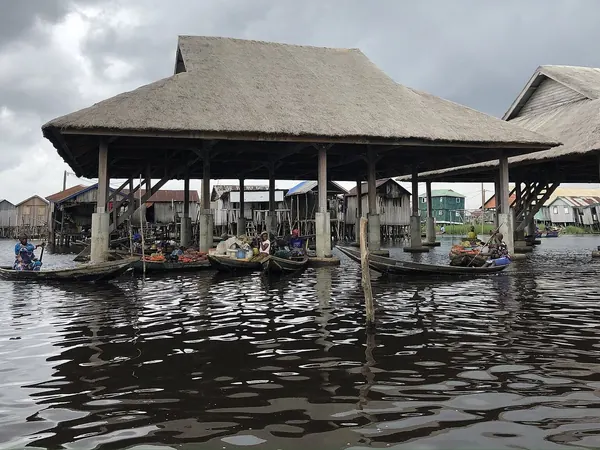
Ganvié stilt village on Lake Nokoué from aboveGanvié, floating market under stilt shelters

DAY 43 – LAGOS, NIGERIA – 160 KM

EXPANDCLOSE+–

Cross at Seme and begin the Nigerian section under the pre-arranged security plan. The mileage is intentionally low because immigration, customs and escort coordination can consume most of the day.
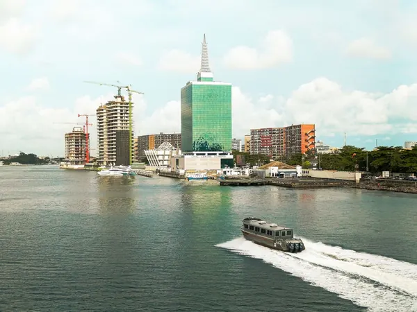
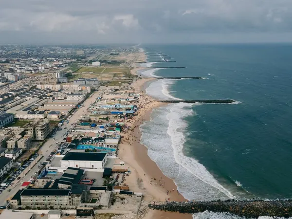
Lagos, the Marina skyline across the lagoonLagos Atlantic coastline from above

DAY 44 – REST DAY IN LAGOS, NIGERIA – 0 KM

EXPANDCLOSE+–

Rest day combined with detailed security coordination for the Nigerian transit. Confirm police handovers, communications, fuel stops and the next several overnight compounds.
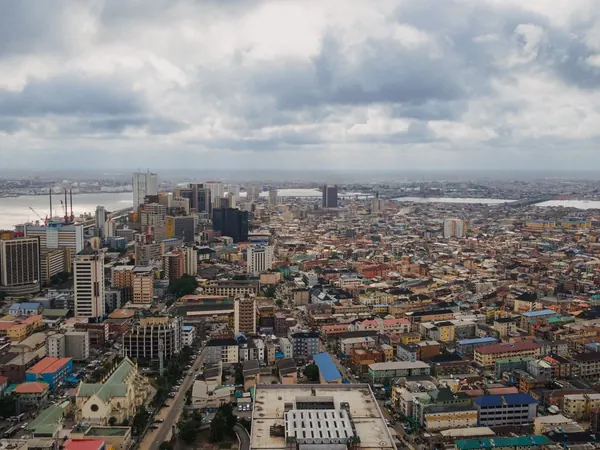
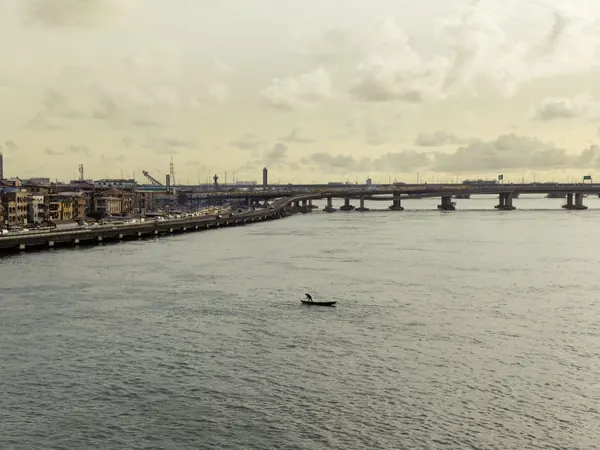
Lagos Island from aboveLagos, Carter Bridge over the lagoon

DAY 45 – BENIN CITY, NIGERIA – 320 KM

EXPANDCLOSE+–

Begin the controlled eastbound transit with daylight-only movement and the agreed security support. Stops should be predetermined rather than improvised.
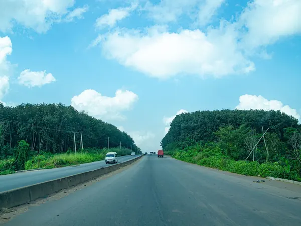
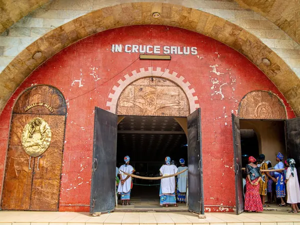
Highway through the forest east of Lagos, towards Benin CityBenin City, Sacred Heart Cathedral entrance

DAY 46 – ASABA / ONITSHA, NIGERIA – 150 KM

EXPANDCLOSE+–

Continue east toward the Niger River on the principal corridor. The short stage allows flexibility for traffic, roadworks and security handovers.
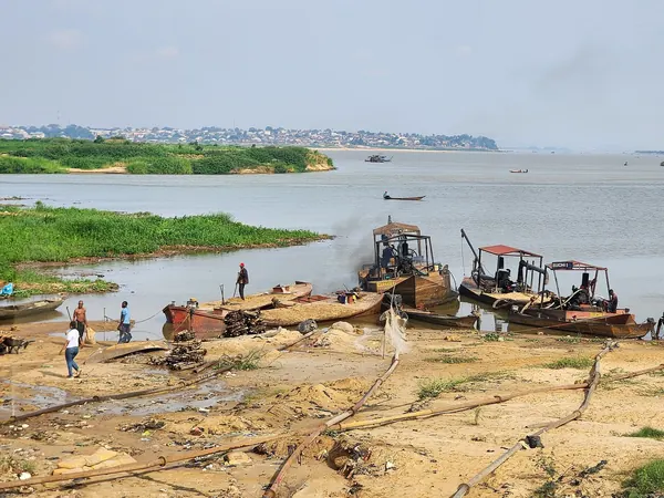
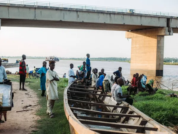
River Niger at Onitsha (Asaba–Onitsha crossing)Riverside life under a bridge on the Niger

DAY 47 – ENUGU, NIGERIA – 120 KM

EXPANDCLOSE+–

A short escorted stage brings the group to Enugu. Arriving early allows the next security arrangements toward Ikom and Cameroon to be confirmed.
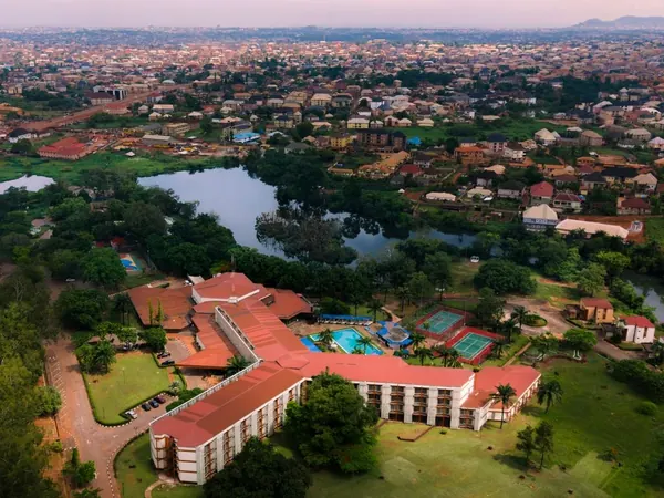
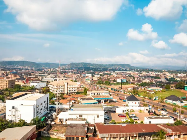
Enugu from the airEnugu city and the Udi hills

DAY 48 – REST DAY IN ENUGU, NIGERIA – 0 KM

EXPANDCLOSE+–

CONTINGENCY. This day exists primarily to absorb Nigerian administrative or security delays. If unused, it becomes a welcome recovery and maintenance day.
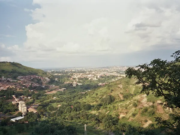
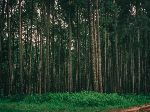
Enugu seen from the hills west of the cityPine forest near Enugu (Ngwo)

DAY 49 – IKOM, NIGERIA – 240 KM

EXPANDCLOSE+–

Continue southeast under controlled movement toward the Cameroon frontier. Ikom is deliberately used as the final Nigerian staging point rather than attempting the border late in the day.
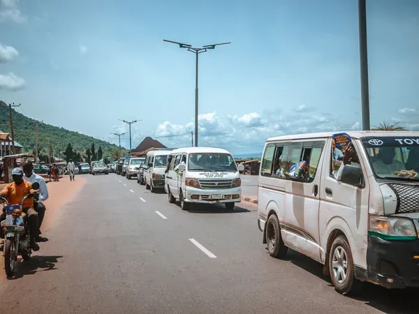
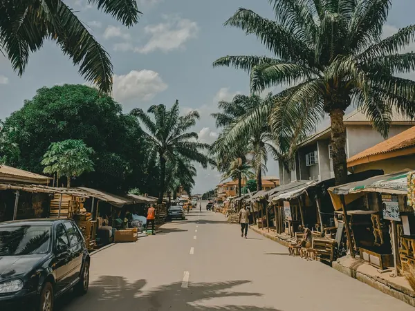
Main road through Enugu, start of the southeast stagePalm-lined road in Enugu State, southeastern Nigeria

DAY 50 – REST DAY IN IKOM, NIGERIA – 0 KM

EXPANDCLOSE+–

CONTINGENCY. Finalize Nigerian exit and Cameroon security arrangements for the expedition's most sensitive border stage. The day can disappear entirely if everything is prepared and the convoy remains on schedule.
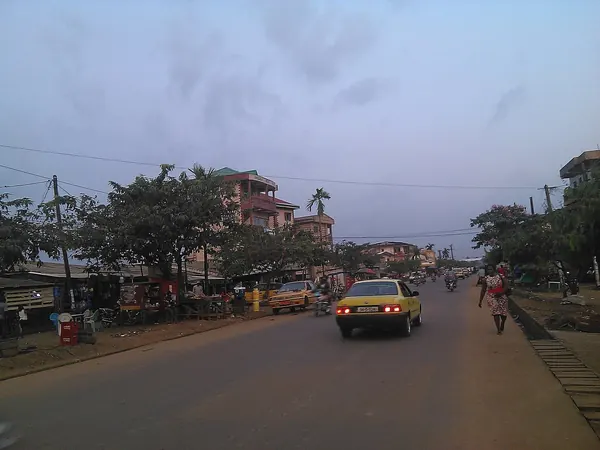
Kumba–Mamfe road, the South-West Cameroon corridor beyond the Ikom crossing

DAY 51 – DOUALA, CAMEROON – 400 KM

EXPANDCLOSE+–

Cross into Cameroon and move through the sensitive South-West corridor under formal governmental security arrangements. The objective is to complete the entire section in daylight and reach secure accommodation in Douala without an intermediate overnight.
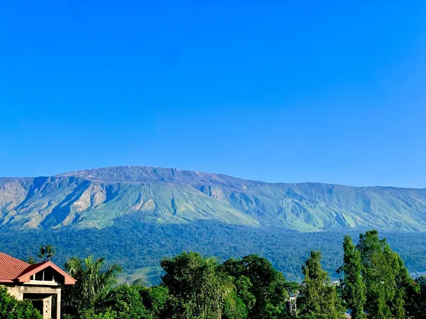
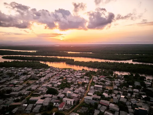
Mount Cameroon seen from Buea (South-West corridor to Douala)Douala and the Wouri estuary from the air

DAY 52 – REST DAY IN DOUALA, CAMEROON – 0 KM

EXPANDCLOSE+–

A necessary recovery day after the demanding Nigeria–Cameroon transit. Both motorcycles and support vehicles receive a detailed inspection while the group rests.
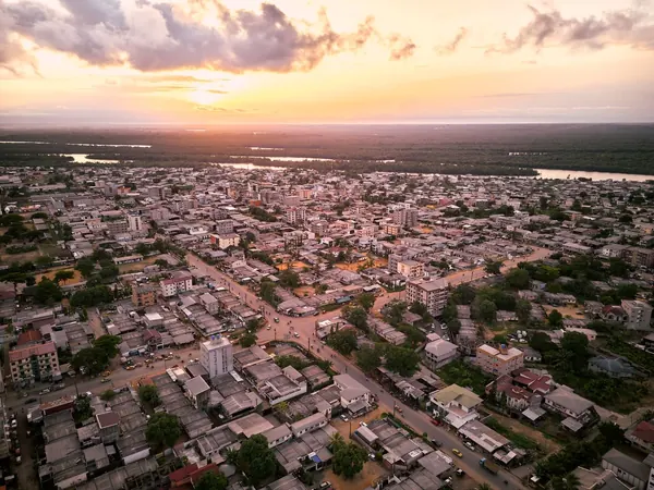
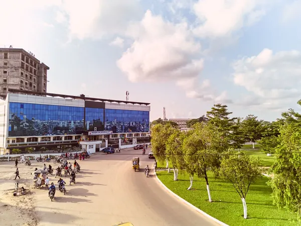
Douala rooftops at golden hourMoto-taxis on a Douala boulevard

DAY 53 – DOUALA / KRIBI EXCURSION, CAMEROON – 340 KM

EXPANDCLOSE+–

CONTINGENCY. If time allows, enjoy a paved excursion to the Atlantic coast and Kribi. If the Nigeria–Cameroon crossing consumed additional time, this is one of the easiest sightseeing days to sacrifice.
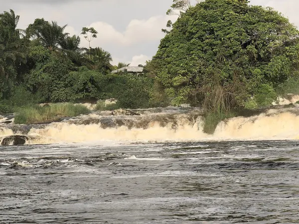
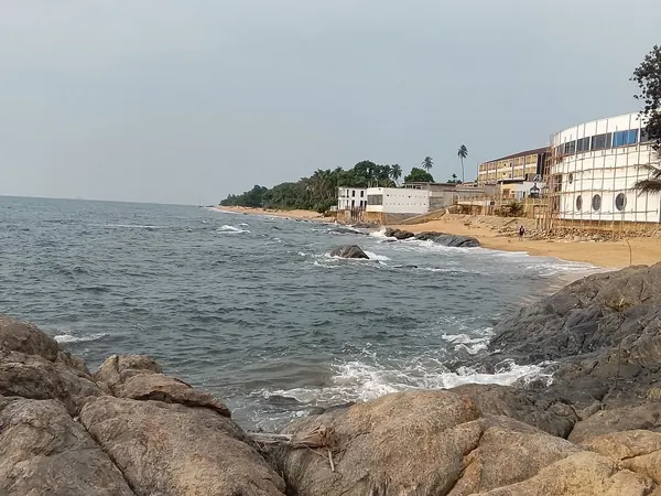
Lobé Falls near KribiKribi beach and rocky Atlantic shore

DAY 54 – YAOUNDÉ, CAMEROON – 240 KM

EXPANDCLOSE+–

Ride inland on the main paved highway to Cameroon's capital. Yaoundé provides better administrative and governmental access before the Gabon crossing.
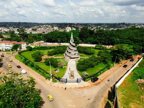
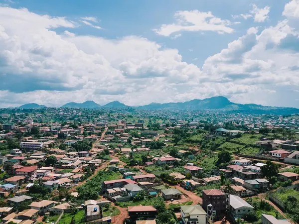
Yaoundé, Reunification MonumentYaoundé spread across its green hills

DAY 55 – REST DAY IN YAOUNDÉ, CAMEROON – 0 KM

EXPANDCLOSE+–

Rest and administration day in the capital. Confirm the Gabon border situation and prepare for the more remote Central African stages ahead.
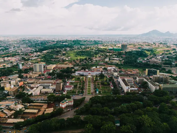
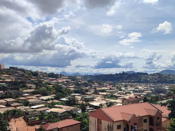
Central Yaoundé, government quarter from the airYaoundé rooftops and surrounding hills

DAY 56 – BITAM, GABON – 330 KM

EXPANDCLOSE+–

Ride south through Ebolowa and cross into northern Gabon. Bitam provides the practical first overnight after completing the border.
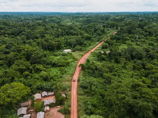
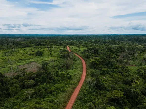
Laterite road through Cameroon's equatorial forest, on the way south to GabonWinding forest track in the Cameroon rainforest belt

DAY 57 – NDJOLÉ, GABON – 370 KM

EXPANDCLOSE+–

Continue south through the forest interior rather than detouring to Libreville. This keeps the expedition on the shortest useful line toward southern Gabon.
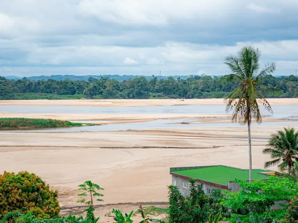
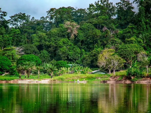
The Ogooué River in the dry season (Moyen-Ogooué, Gabon)Rainforest on the banks of the Ogooué, Gabon

DAY 58 – MOUILA, GABON – 330 KM

EXPANDCLOSE+–

Continue south through sparsely populated tropical countryside. Fuel and daylight planning become increasingly important in this part of Gabon.
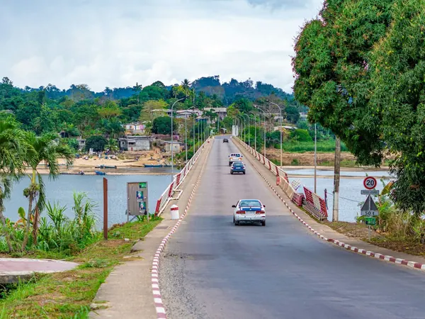
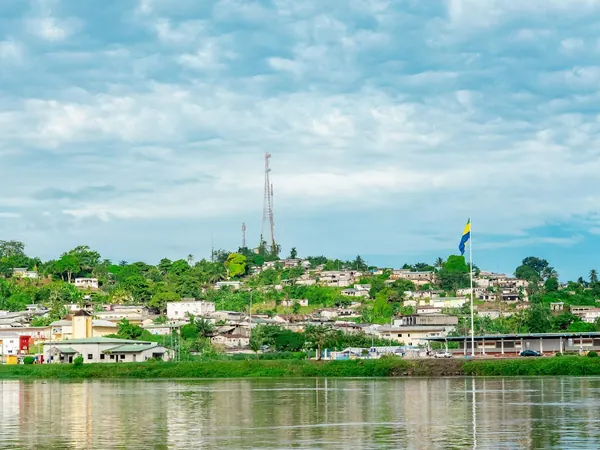
Lambaréné bridge over the Ogooué, on the N1 southLambaréné on the Ogooué River

DAY 59 – NDENDÉ, GABON – 150 KM

EXPANDCLOSE+–

A short stage positions the convoy immediately before the difficult Gabon–Congo corridor. Arriving early allows detailed local checks on the following day's road conditions.
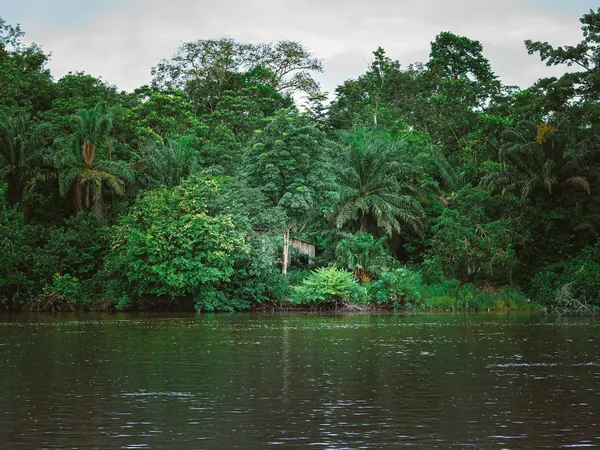
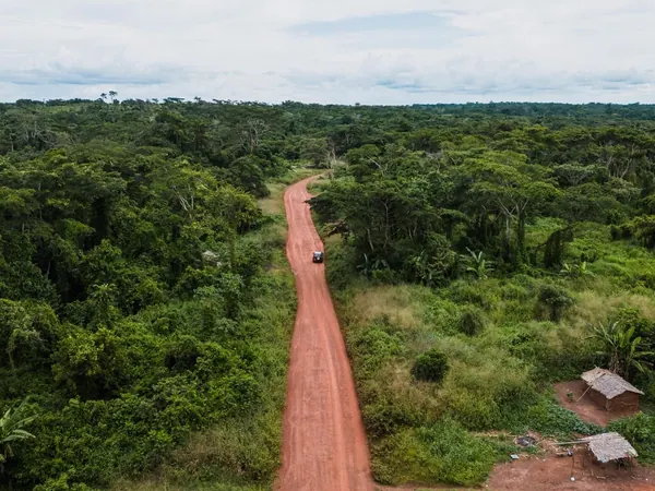
Gabonese rainforest along a river (Moyen-Ogooué region)Red-earth road through the Central African forest

DAY 60 – REST DAY IN NDENDÉ, GABON – 0 KM

EXPANDCLOSE+–

Rest, service and preparation day before entering Congo. The support team should use it to verify the road, bridges, weather and border status toward Dolisie.
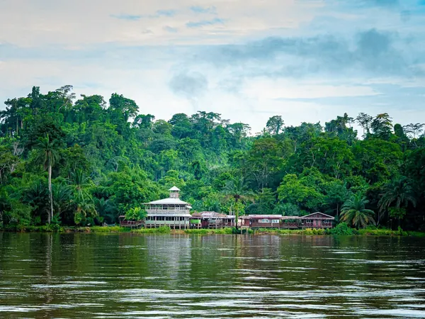
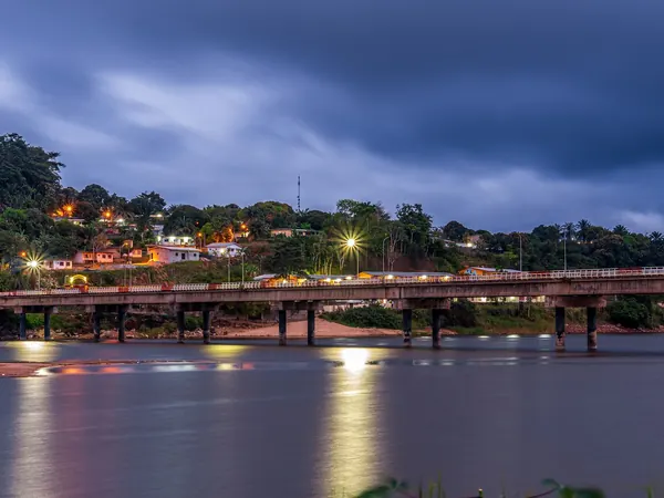
Riverside village in the Gabonese rainforest (Lambaréné area)Ogooué River bridge at dusk (Lambaréné, Gabon)

DAY 61 – DOLISIE, REPUBLIC OF CONGO – 280 KM

EXPANDCLOSE+–

Cross into the Republic of Congo on one of the route's more uncertain road-surface days. Expect broken pavement, construction or dirt depending on how much of the corridor has been upgraded by 2028.
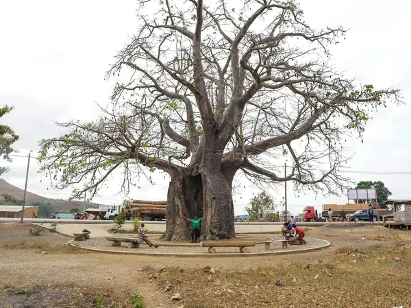
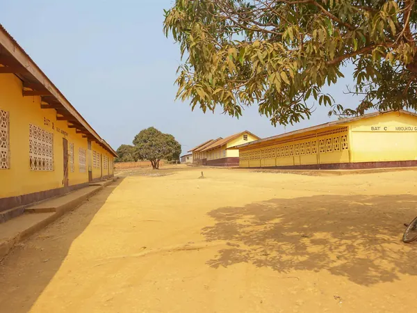
Dolisie, baobab roundabout with timber trucksDolisie, yellow school buildings

DAY 62 – MADINGOU, REPUBLIC OF CONGO – 115 KM

EXPANDCLOSE+–

Follow the main RN1 east to Madingou on comparatively easy road. The short stage positions us for the P11 route south toward the DRC.
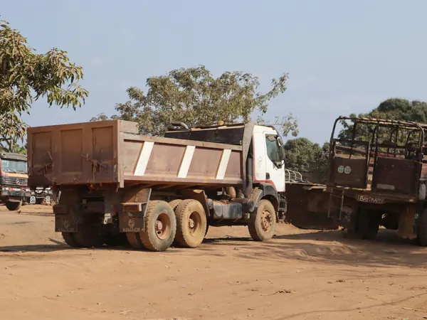
Timber trucks in Dolisie, setting off along the RN1 corridor

DAY 63 – LUOZI, DR CONGO – 220 KM

EXPANDCLOSE+–

Leave the RN1 and use the P11 corridor toward the Congo–DRC frontier before continuing toward Luozi. This is a major border and road-condition day where government coordination will be essential.
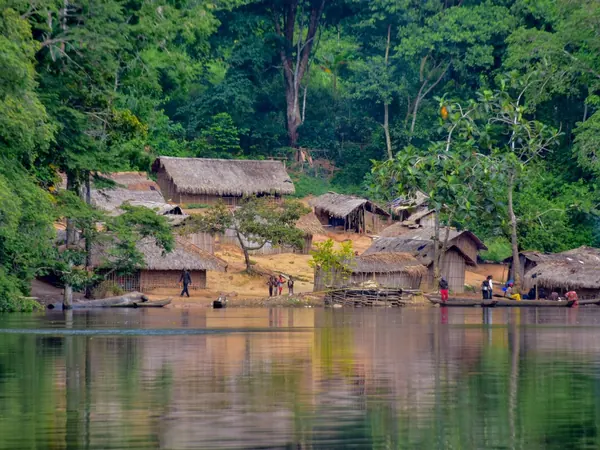
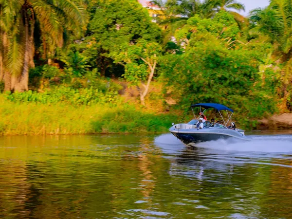
Riverside village in the DR Congo forestBoat on the Congo River

DAY 64 – KIMPESE, DR CONGO – 130 KM

EXPANDCLOSE+–

Cross the Congo River using the Luozi ferry and continue toward Kimpese. This dramatically shorter DRC transit avoids the old Cabinda, Muanda and Matadi detour.
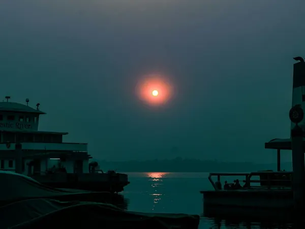
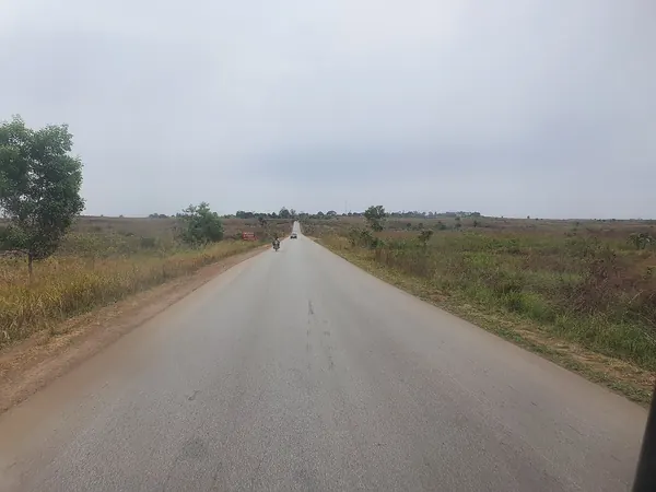
Congo River ferries at sunset (Kinshasa)Route Nationale 1 through the Kongo Central savanna toward Kimpese

DAY 65 – REST DAY IN KIMPESE, DR CONGO – 0 KM

EXPANDCLOSE+–

CONTINGENCY. This buffer absorbs ferry, border, road or security delays from the previous two days. If unused, it becomes a valuable rest and vehicle-check day before entering Angola.
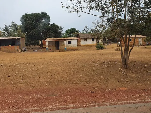
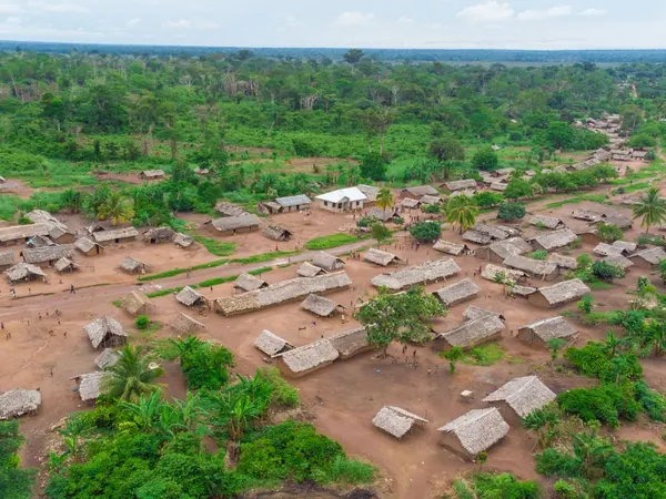
Village on the RN1 in Kongo CentralRural village in the DR Congo countryside from the air

DAY 66 – MBANZA KONGO, ANGOLA – 150 KM

EXPANDCLOSE+–

Continue south via Songololo and cross directly from DRC into mainland Angola. This route avoids both Matadi and the Cabinda enclave, significantly reducing borders and unnecessary distance.
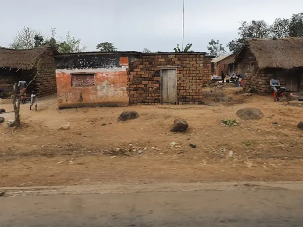
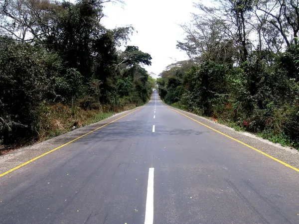
Roadside village on the RN1 in Kongo Central, toward SongololoPaved highway through northern Angola's forest

DAY 67 – LUANDA, ANGOLA – 500 KM

EXPANDCLOSE+–

Follow the principal southbound road toward the Angolan capital. It is a long riding day but keeps us on pavement and completes the difficult Central African transition.
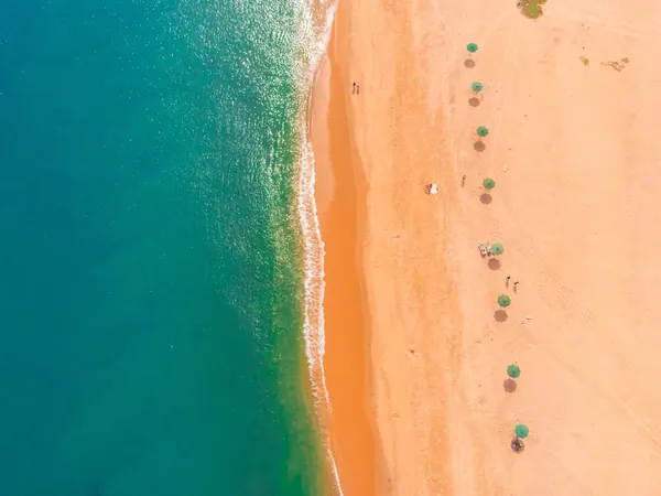
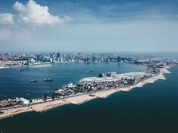
Bengo coast north of Luanda from the airLuanda Bay and the Ilha from the air

DAY 68 – REST DAY IN LUANDA, ANGOLA – 0 KM

EXPANDCLOSE+–

Full rest and major mechanical-service day after Congo and DRC. Luanda provides the best facilities for repairs, supplies and medical needs before the long southern section.
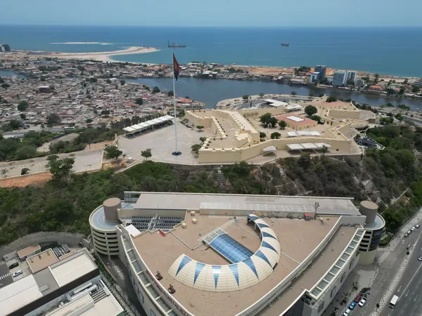
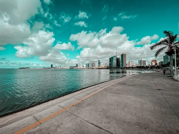
Luanda, Fortress of São Miguel above the bayLuanda, the Marginal bayfront promenade

DAY 69 – REST DAY IN LUANDA, ANGOLA – 0 KM

EXPANDCLOSE+–

CONTINGENCY. This is one of the expedition's most valuable floating recovery days because it sits immediately after the highest-risk logistical section. If no time has been lost, riders get another proper rest while the support team completes preventative maintenance.
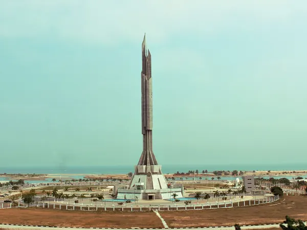
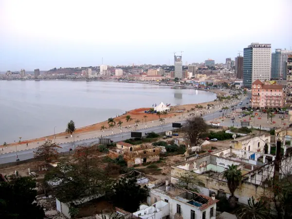
Luanda, Agostinho Neto MausoleumLuanda, the Marginal and bay from above

DAY 70 – KISSAMA EXCURSION, LUANDA, ANGOLA – 220 KM

EXPANDCLOSE+–

CONTINGENCY. If the expedition is on time, use the day for a wildlife or countryside excursion south of Luanda. It can be removed completely if Central Africa has consumed extra days.
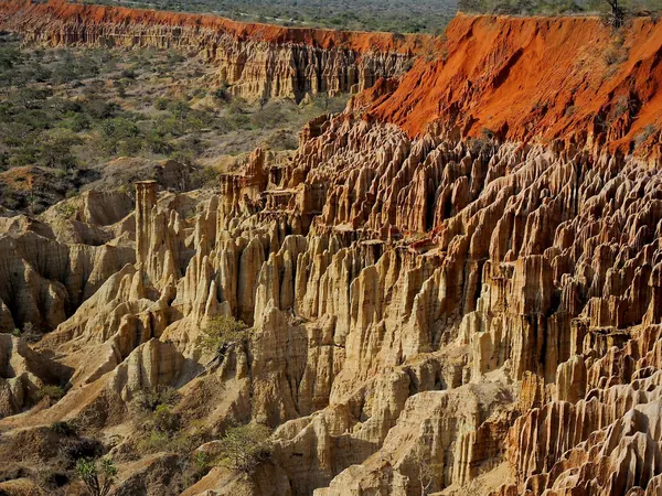
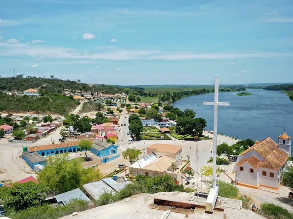
Miradouro da Lua eroded cliffs, south of LuandaMuxima and the Kwanza River, edge of Kissama National Park

DAY 71 – SUMBE, ANGOLA – 330 KM

EXPANDCLOSE+–

Leave the capital and return to the Atlantic route south. The roads and overall operating environment should now become progressively easier.
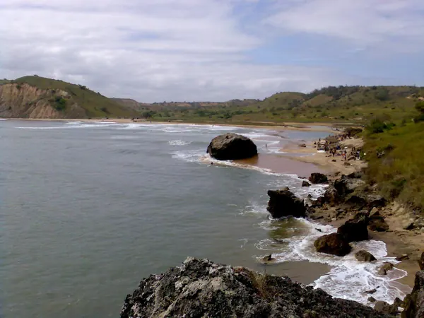
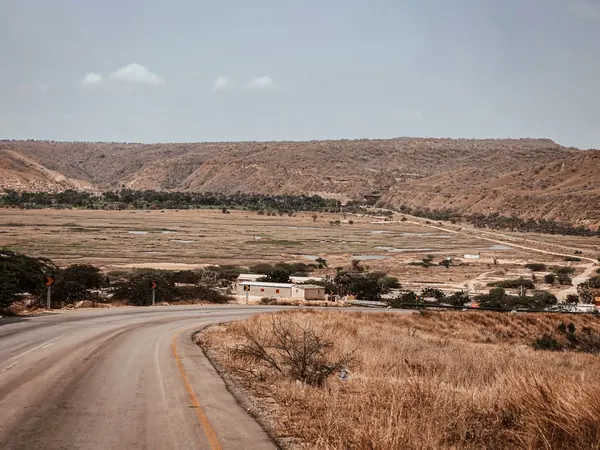
Cabo Ledo beach on the coastal road southRoad through the arid coastal hills of western Angola

DAY 72 – BENGUELA, ANGOLA – 260 KM

EXPANDCLOSE+–

Continue along Angola's increasingly scenic coastline toward Benguela and Lobito. This is a comparatively relaxed day with much better tourism and accommodation infrastructure.
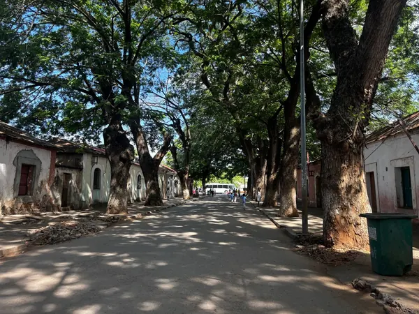
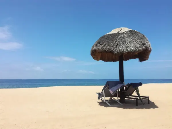
Lobito, tree-lined historic streetRestinga beach, Lobito

DAY 73 – REST DAY IN BENGUELA, ANGOLA – 0 KM

EXPANDCLOSE+–

Take a genuine rest day on the coast after the long Central African transit. It also provides a useful opportunity for another service before the southern Angolan highlands.
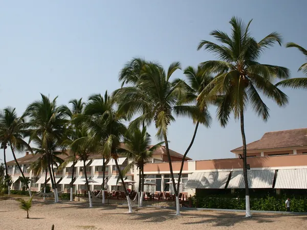
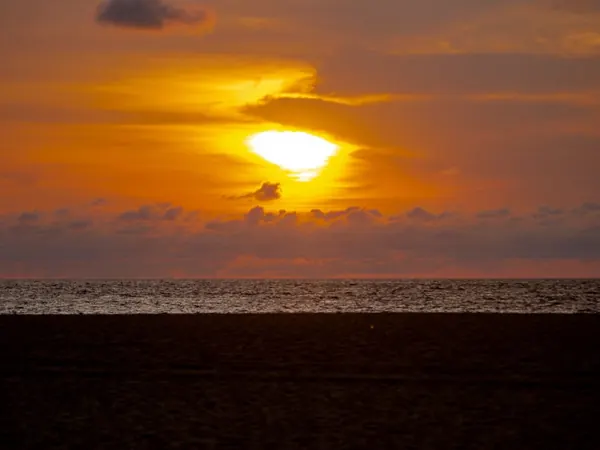
Palm-lined seafront of the Restinga, LobitoSunset over Angola's Atlantic coast

DAY 74 – LUBANGO, ANGOLA – 460 KM

EXPANDCLOSE+–

Turn inland and climb toward Lubango through dramatic changing landscapes. This is a longer paved riding day but positions us for one of Angola's signature scenic experiences.
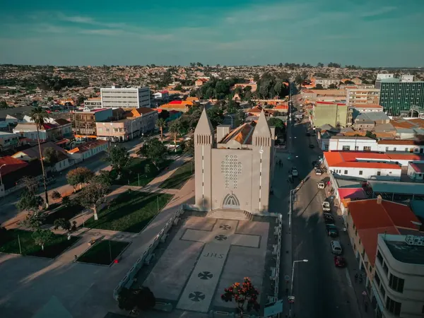
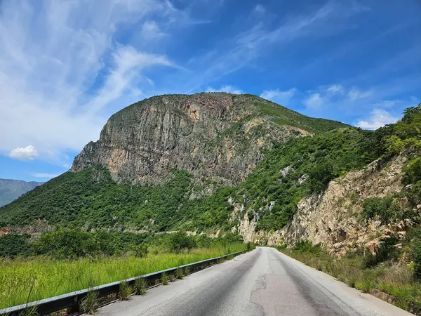
Lubango, city centre and cathedral from the airMountain road climbing through Huíla toward Lubango

DAY 75 – TUNDAVALA & SERRA DA LEBA LOOP, LUBANGO, ANGOLA – 150 KM

EXPANDCLOSE+–

Spend the day riding the spectacular escarpment roads around Lubango, including Tundavala and Serra da Leba. The loop provides major sightseeing value without requiring a long detour toward Namibe.
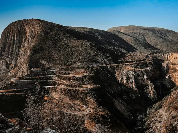
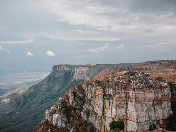
Serra da Leba hairpin roadHuíla escarpment cliffs near Tundavala

DAY 76 – ONDJIVA, ANGOLA – 420 KM

EXPANDCLOSE+–

Head south toward the Namibian frontier on the principal highway. Ondjiva provides a practical final Angolan overnight and allows an early border start.
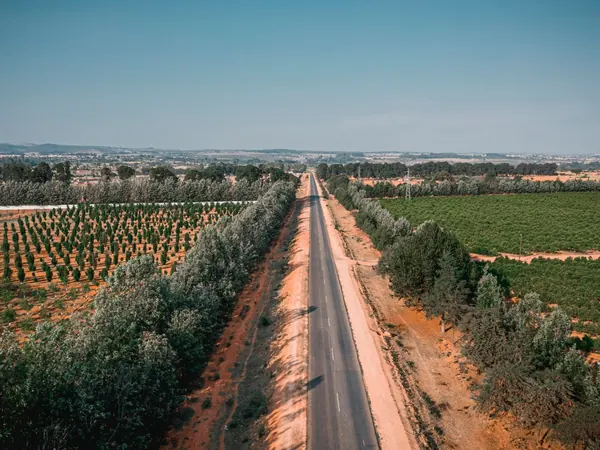
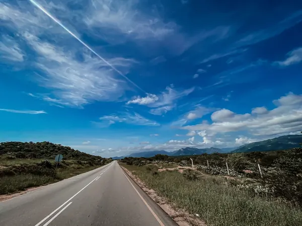
Highway south through the farmland of HuílaOpen road across southern Angola

DAY 77 – OSHAKATI, NAMIBIA – 250 KM

EXPANDCLOSE+–

Cross into Namibia and continue south to Oshakati. Border formalities should be considerably more predictable than those encountered farther north.
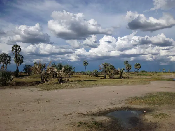
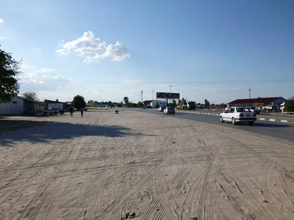
Makalani palms of Ovamboland, northern NamibiaMain road at Ondangwa toward Oshakati

DAY 78 – ETOSHA, NAMIBIA – 300 KM

EXPANDCLOSE+–

Ride south toward Etosha National Park. The afternoon can be used for the first wildlife viewing depending on arrival time.
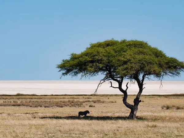
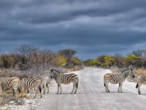
Lone acacia on the edge of the Etosha PanEtosha National Park, zebras crossing the park road

DAY 79 – ETOSHA SAFARI DAY, NAMIBIA – 0 KM

EXPANDCLOSE+–

Full safari and rest day with the motorcycles parked. This is one of the expedition's major wildlife experiences and provides a complete break from riding.
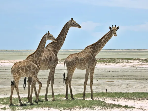
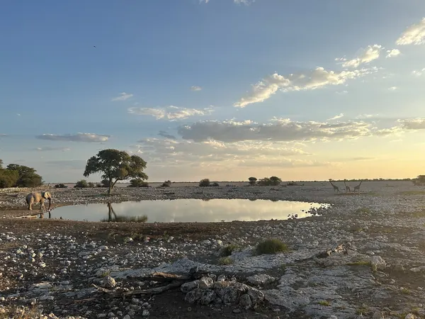
Etosha National Park, giraffes by the panEtosha, Okaukuejo waterhole at dawn

DAY 80 – WINDHOEK, NAMIBIA – 420 KM

EXPANDCLOSE+–

Head south on good paved roads toward the Namibian capital. Windhoek is the logical location for the expedition's final major motorcycle and 4x4 service.
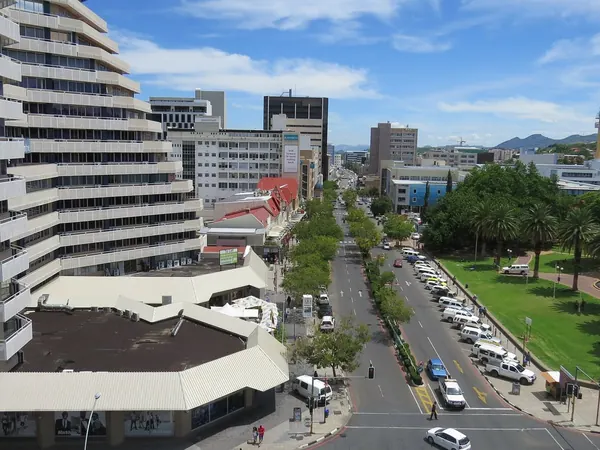
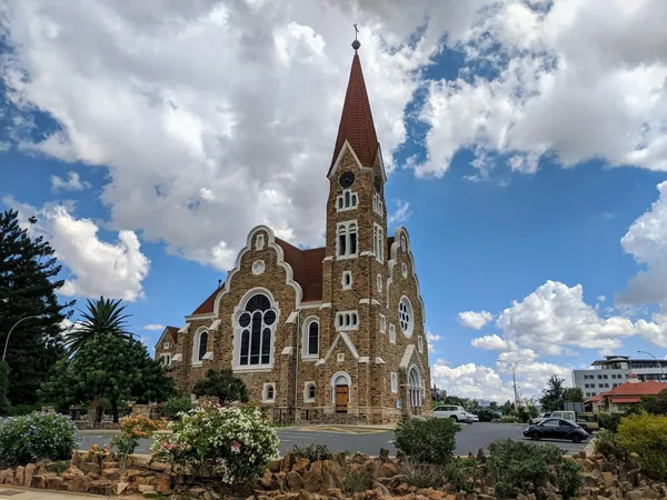
Downtown Windhoek, Independence AvenueWindhoek, Christuskirche

DAY 81 – REST DAY IN WINDHOEK, NAMIBIA – 0 KM

EXPANDCLOSE+–

Rest, service and resupply day. Prepare tyres and vehicles particularly carefully for the upcoming gravel sections around Sesriem and Fish River Canyon.
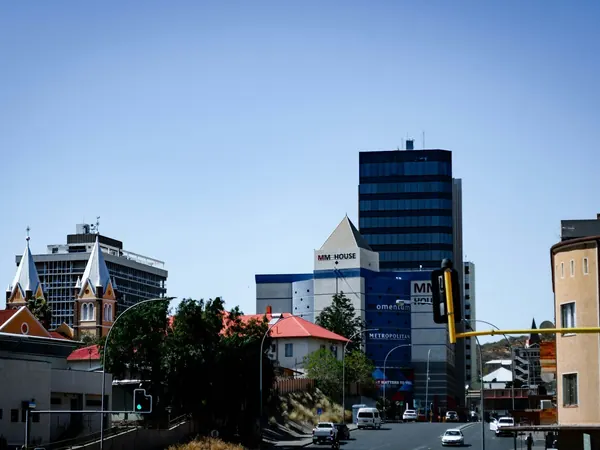
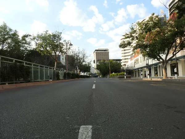
Windhoek city centreWindhoek, tree-lined central avenue

DAY 82 – SESRIEM, NAMIBIA – 350 KM

EXPANDCLOSE+–

Ride southwest into the Namib Desert with significant gravel sections expected. The scenery becomes increasingly dramatic as we approach the giant dunes.
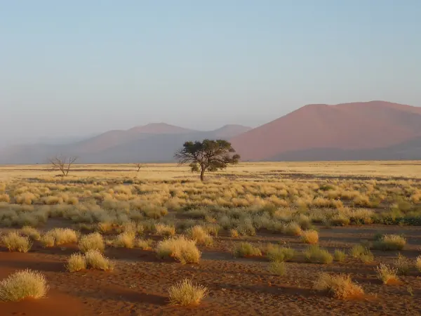
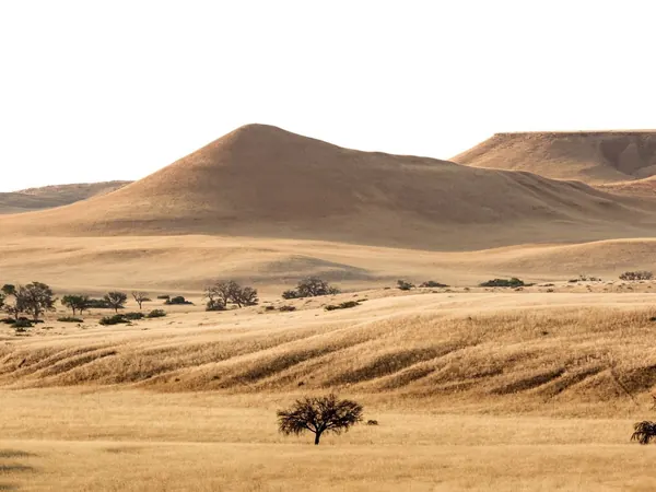
Sesriem, grassland and red dunes at sunsetNamib dunes and grassland near Solitaire, on the way to Sesriem

DAY 83 – SOSSUSVLEI & DEADVLEI, NAMIBIA – 130 KM

EXPANDCLOSE+–

Spend the day exploring Sossusvlei, Deadvlei and the surrounding dunes, using 4x4 transport where deep sand makes more sense than taking all motorcycles. This is one of the expedition's defining desert days.
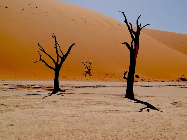
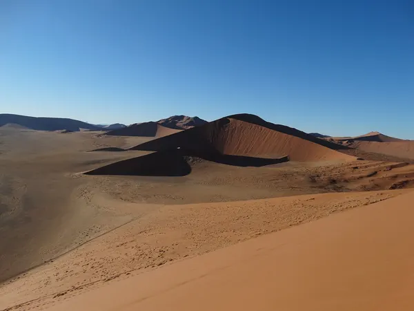
Deadvlei, camelthorn trees and red dunesSossusvlei dune field

DAY 84 – SESRIEM CANYON, NAMIBIA – 40 KM

EXPANDCLOSE+–

CONTINGENCY. If we are on schedule, use the day for Sesriem Canyon, sunrise or additional desert exploration. It can be sacrificed without affecting the essential Namibia experience.
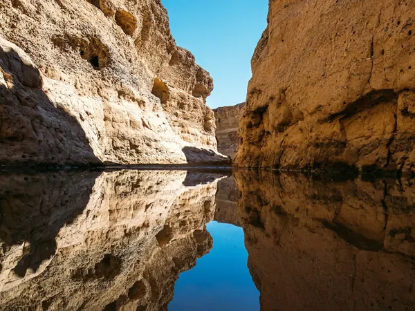
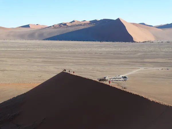
Sesriem Canyon, narrow gorge with poolsDune 45 in the Sossusvlei valley

DAY 85 – KEETMANSHOOP, NAMIBIA – 460 KM

EXPANDCLOSE+–

Continue southeast across Namibia on a mixture of gravel and paved roads. This is a long transit stage designed to regain the main southbound corridor efficiently.
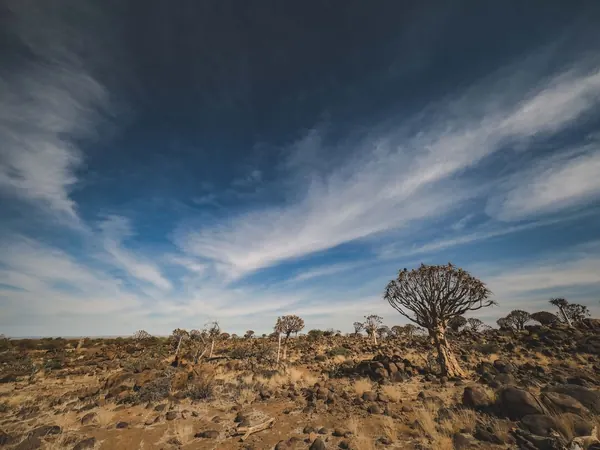
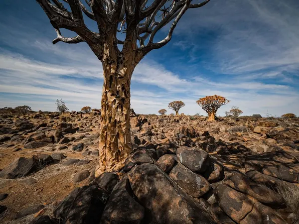
Quiver Tree Forest near KeetmanshoopQuiver trees on the dolerite rocks near Keetmanshoop

DAY 86 – FISH RIVER CANYON, GRUNAU, NAMIBIA – 180 KM

EXPANDCLOSE+–

A shorter ride brings us to the immense Fish River Canyon. The afternoon provides time for viewpoints and a relaxed final Namibian wilderness overnight.
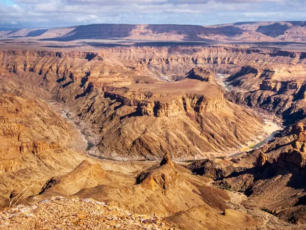
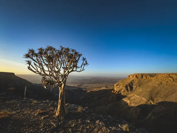
Fish River Canyon panoramaQuiver tree on the rim of Fish River Canyon

DAY 87 – SPRINGBOK, SOUTH AFRICA – 350 KM

EXPANDCLOSE+–

Ride south to the Orange River, complete the Namibia–South Africa border and continue into Namaqualand. Springbok marks the beginning of the expedition's final country.
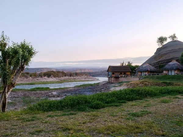
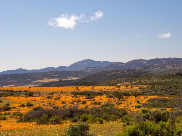
Orange River at Noordoewer, the Namibia–South Africa borderNamaqualand spring flowers, Northern Cape

DAY 88 – PATERNOSTER, SOUTH AFRICA – 430 KM

EXPANDCLOSE+–

Follow the west coast south through the vast open landscapes of the Northern and Western Cape. Paternoster provides an attractive Atlantic overnight before the final approach to Cape Town.
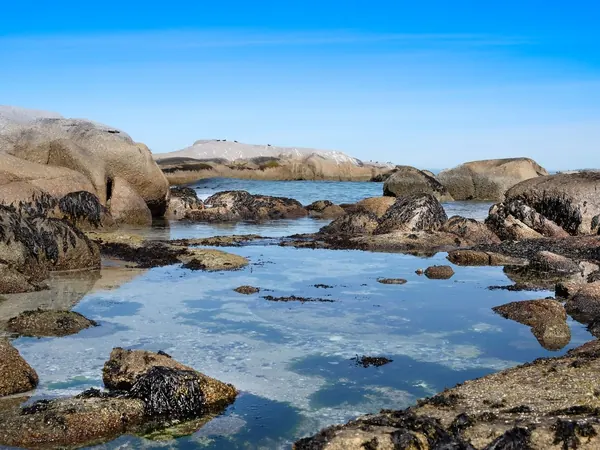
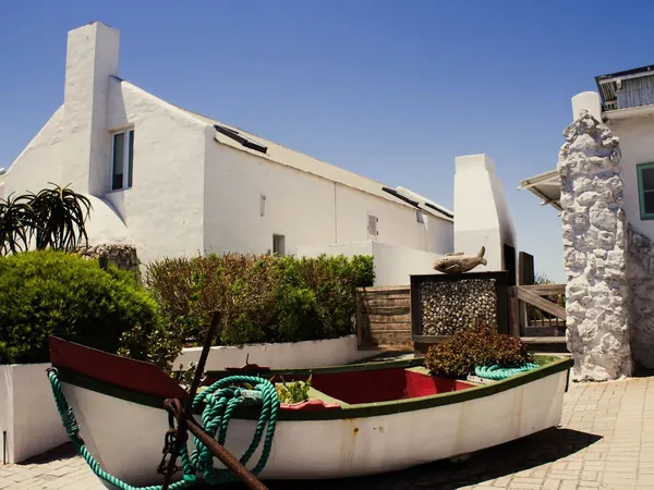
Rock pools on the Paternoster shorelinePaternoster, whitewashed fishermen's cottages and boat

DAY 89 – CAPE TOWN, SOUTH AFRICA – 160 KM

EXPANDCLOSE+–

Complete the main Málaga-to-Cape-Town overland journey with a short celebratory ride into the city. Arriving with several days remaining protects the expedition against accumulated delays farther north.
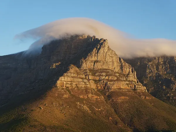
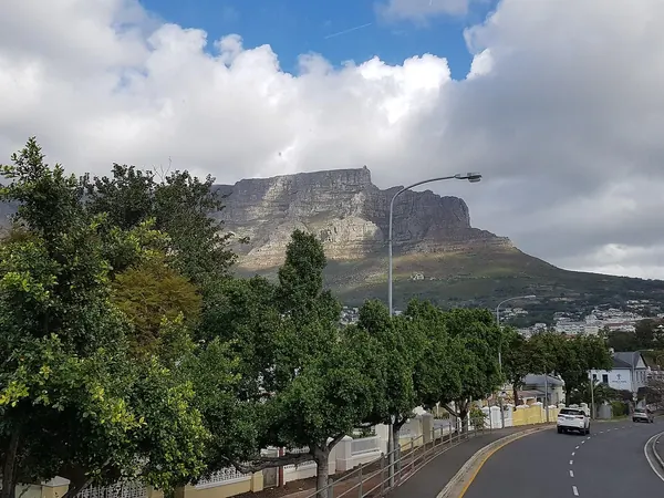
Cape Town, Table Mountain with its tablecloth cloudRiding into Cape Town beneath Table Mountain (Kloof Nek Road)

DAY 90 – SOUTHERN TIP OF AFRICA LOOP, SOUTH AFRICA – 450 KM

EXPANDCLOSE+–

A long day out and back to Cape Agulhas, the true southern tip of Africa, where the Atlantic and the Indian Ocean meet at the foot of the lighthouse. Having ridden from the Strait of Gibraltar to here, it is the photograph the whole expedition has been building towards.
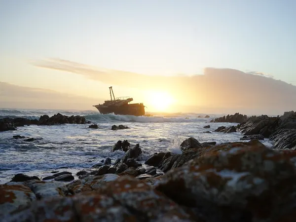
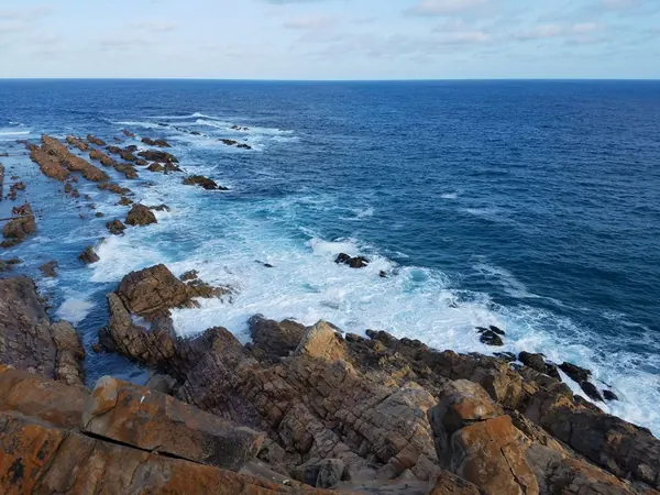
L'Agulhas coast and the Meisho Maru wreck at the southern tip of AfricaRocky shore at Cape Agulhas

DAY 91 – REST DAY IN CAPE TOWN, SOUTH AFRICA – 0 KM

EXPANDCLOSE+–

A final rest and contingency day with no required riding. It can absorb an accumulated delay while still allowing the expedition to finish in Cape Town as planned.
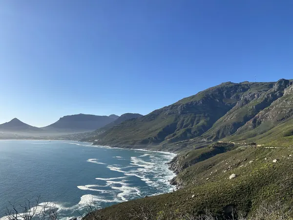
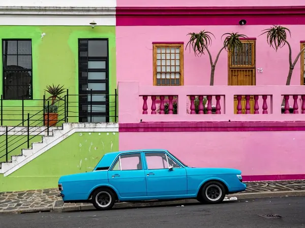
Chapman's Peak Drive above Hout BayBo-Kaap, Cape Town

DAY 92 – CAPE WINELANDS LOOP, CAPE TOWN, SOUTH AFRICA – 180 KM

EXPANDCLOSE+–

CONTINGENCY. If all earlier contingency days remain intact, finish with a relaxed loop through Stellenbosch and Franschhoek. If the expedition has suffered delays, this optional day disappears and Cape Town remains the final destination.
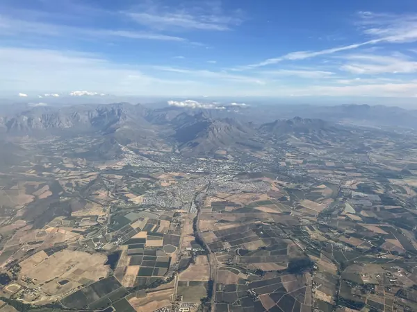
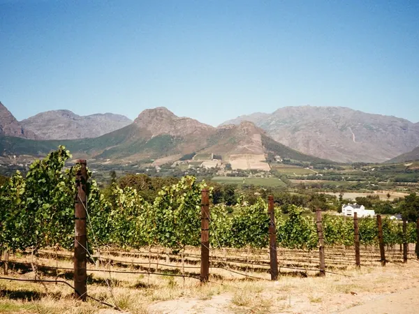
Stellenbosch and the Cape Winelands from the airVineyards and mountains of Franschhoek
INCLUDED+–
  • ✓ Small group expedition – Maximum 12 riders
  • ✓ Professional multilingual MotoDreamer Tour Leader
  • ✓ Dedicated Support Team, Mechanic and 2 Support 4x4 Vehicles
  • ✓ 91 nights accommodation in shared rooms, with approximately 15% of nights expected to be camping due to the remote nature of the expedition (Single-room upgrades available where accommodation permits. If a suitable match is not available, a single supplement will apply)
  • ✓ All breakfasts
  • ✓ Group activities and entry fees specifically listed in the final itinerary
  • ✓ Ferry crossing from Spain to Morocco, Congo river crossing
  • ✓ Transfers from Málaga Airport on the official arrival day and to Cape Town International Airport on the official departure day
  • ✓ Pre-arranged border assistance, local fixers and governmental/security coordination where required
  • ✓ Pre-tour Preparation Guide, paperwork checklist and Expedition Briefing
  • ✓ MotoDreamer 20th Anniversary Expedition apparel/gift
  • ✓ Up to 25% discount on selected riding gear and accessories from MotoDreamer partners
  • ✓ All applicable tour taxes
  • WITH RENTAL MOTORCYCLE
  • + Rental motorcycle for the complete expedition
  • + Official authorization and documentation required to cross international borders with the rental motorcycle, including Carnet de Passage and notarized permits
  • + Motorcycle fuel, maintenance, services and consumable parts throughout the expedition
  • + Shipping to start point and back from end point
  • + Road tolls and applicable road-use charges
  • + Mandatory local 3rd Party Liability Insurance where required
NOT INCLUDED+–
  • ✗ Airfare to Málaga and from Cape Town
  • ✗ Motorcycle model upgrades or accommodation upgrades
  • ✗ Mandatory Motorcycle Damage and Theft Liability Reduction Insurance
  • ✗ Lunches, dinners, snacks and drinks unless specifically stated as included
  • ✗ Personal visas, visa fees, vaccinations, passport costs and individual immigration paperwork
  • ✗ Personal travel, medical and evacuation insurance with cancellation coverage (Available through Global Rescue)
  • ✗ Optional activities, excursions or entry fees not specifically listed as included
  • ✗ Personal expenses including laundry, minibar, telephone charges and souvenirs
  • ✗ Traffic fines, damages or expenses resulting from rider negligence
  • ✗ Tips to guides, drivers, hotel staff and local support personnel
  • ✗ Any costs associated with using a personal motorcycle, including fuel, maintenance, repairs, transport/shipping, permits, Carnet or temporary import documentation and insurances.

MOTORCYCLES AVAILABLE

TESTIMONIALS
THE COMPLETE GUIDE TO THE 92-DAY AFRICA TOP 2 BOTTOM EXPEDITION

Everything below comes from the expedition itself: the 92-day route from Málaga to Cape Town, the day-by-day itinerary further up this page, and twenty years of running motorcycle adventures on five continents. If you are weighing up whether to ride the length of Africa with us, this is the long answer: how the riding actually feels, what you will see between the Strait of Gibraltar and Cape Agulhas, and the practical details of bikes, group size and booking.

WHY RIDE AFRICA TOP TO BOTTOM BY MOTORCYCLE?

+–

Because nobody does. The West African corridor from Morocco to the Cape is the last great overland route on the planet that is still an expedition rather than a tour: seventeen countries, a dozen serious borders, the Sahara, the Congo basin and the Namib, one after another, on a single continuous ride.

In 2028 MotoDreamer turns twenty. We have spent those years running Colombia, the Andes, the Amazon, Patagonia, the Nordkapp and Namibia, and Mike has already ridden or driven more than half of the destinations on this route on his own. This is the first time we take a group the whole way, and it is deliberately the biggest thing we have ever organised.

You come back with the length of Africa in your mirrors — 17,825 kilometres, from the Strait of Gibraltar to Cape Agulhas — and with the kind of stories that only 92 days on the road can produce.

HOW HARD IS THE RIDING? 20% OFF-ROAD, 60% COMFORT, 100% FUN

+–

The route is planned to stay on pavement wherever pavement exists. Morocco, Mauritania, Senegal, the Ivorian and Ghanaian coast, Angola's main roads and South Africa are largely tarmac. The hard sections are known and short: the Guinea–Côte d'Ivoire corridor, the Gabon–Congo crossing, the P11 into the DRC and the Luozi ferry, and the gravel of Sesriem and Fish River Canyon in Namibia. Expect broken pavement, construction and dirt on those days, and expect the plan to adapt to what we find on the ground.

Distances are moderate on purpose. Most riding days are 150–350 km; only a handful exceed 450 km, and they are on good roads. Eleven days in the schedule are marked as contingency — excursions that happen if we are on time and disappear if a border has cost us a day. That is what keeps a 92-day expedition realistic.

Roughly 15% of nights will be camping, because in some stretches there is simply nothing else. Two 4x4 support vehicles carry luggage, spares, fuel and a mechanic; you ride with a day bag.

THE ROUTE: MÁLAGA TO CAPE TOWN, COUNTRY BY COUNTRY

+–

Spain and Morocco (days 1–11): the ferry across the Strait, Casablanca, Marrakech, then the long Atlantic run south through Agadir, Tan-Tan, Laâyoune and Dakhla into Western Sahara.

Mauritania and Senegal (days 12–19): the Guerguerat border, the desert highway to Nouakchott, then Saint-Louis, Djoudj, Dakar and Gorée Island before turning inland at Tambacounda.

Guinea, Côte d'Ivoire, Ghana, Togo and Benin (days 20–42): the Fouta Djallon highlands, the forest region around Nzérékoré, Man and Yamoussoukro, the coast to Grand-Bassam and Abidjan, Cape Coast and Elmina, Accra and the old Danish Gold Coast, Lomé, Ouidah and the stilt village of Ganvié.

Nigeria and Cameroon (days 43–55): an escorted, daylight-only transit from Lagos through Benin City, Asaba, Enugu and Ikom, then the South-West corridor to Douala and Yaoundé under formal security coordination.

Gabon, Congo and the DRC (days 56–66): Bitam, Ndjolé, Mouila and Ndendé through the forest interior; Dolisie and Madingou in the Republic of Congo; the Luozi ferry across the Congo River and Kimpese in the DRC; then the Lufu border straight into mainland Angola, avoiding Cabinda and Matadi entirely.

Angola and Namibia (days 67–87): Luanda, the coast to Sumbe and Benguela, the Serra da Leba escarpment above Lubango, then Etosha, Windhoek, Sossusvlei and Deadvlei, Keetmanshoop and Fish River Canyon.

South Africa (days 88–92): Springbok, the west coast to Paternoster, the arrival in Cape Town, a loop to Cape Agulhas — the true southern tip of Africa, where the Atlantic and the Indian Ocean meet — and a final day in the Winelands if every contingency day is still intact.

YOUR MOTORCYCLE: BRING YOUR OWN OR RENT — ONE-WAY ACROSS A CONTINENT

+–

The base price is for a rider on their own motorcycle. You are responsible for your bike's shipping to Málaga and home from Cape Town, its Carnet de Passage, temporary import paperwork, insurance, fuel and maintenance. Our team handles the border coordination for the convoy as a whole, but the documents for your own bike are yours.

Or rent from us and let us carry all of that. A rental CFMoto 450MT, 800MT-X or 1000MT-X comes with the Carnet and notarized permits for every border, fuel, servicing and consumables for the whole expedition, shipping to the start and back from the finish, tolls and the mandatory local third-party insurance. The Mandatory Damage and Theft Liability Reduction Insurance is the only thing that goes on top.

The 450MT is the lightest and easiest on the rough days; the 800MT-X and 1000MT-X carry more comfortably on the long tarmac stages. If you are unsure which fits you, ask — we have ridden all three on this kind of terrain.

PRACTICAL ANSWERS: GROUP, PRICE & BOOKING THE EXPEDITION

+–

The group is capped at 12 riders. A $999 deposit secures your seat; the balance is due before departure. Pillions are welcome at the passenger rate, and a single room can be added where the accommodation allows it.

Visas are your own responsibility, but not your own problem: our pre-tour guide lists every visa, vaccination and document you need, in the order you need them, and the support team has pre-arranged fixers at the borders that require them. Start the paperwork early — some of the Central African visas take time.

Dates: January 6 to April 6, 2028. Arrival in Málaga on day 1, departure from Cape Town on day 92. Airport transfers are included on the official days.

WHAT RIDERS SAY

First departure January 2028 — twenty years of MotoDreamer riders behind it

★ 5.0 on TripAdvisor (27 reviews)  ·  ★ 4.6 on Google (62 reviews)

FREQUENTLY ASKED QUESTIONS ABOUT THE 92-DAY AFRICA TOP 2 BOTTOM EXPEDITION
TOUR AT A GLANCE — DAY BY DAY

+–
DayRoute
Day 1ARRIVAL TO MÁLAGA, SPAIN – 0 KM. Arrival day for riders, motorcycles and support vehicles, with the entire convoy assembled in Málaga. Use the day for introductions, paperwork checks, bike preparation and the expedition briefing:
Day 2TANGIER, MOROCCO – 150 KM. Ride to the Strait of Gibraltar and cross by ferry into Morocco for the official start of the African section. Allow plenty of time for Moroccan immigration and temporary vehicle-import formalities before heading to the hotel.
Day 3CASABLANCA, MOROCCO – 340 KM. Follow the fast Atlantic corridor south, making this a straightforward introduction to riding in Morocco. Casablanca gives us the Hassan II Mosque and the famous Bogart connection without taking us away from the southbound route.
Day 4MARRAKECH, MOROCCO – 240 KM. A relatively short paved ride brings the convoy inland to one of Morocco's essential destinations. Arriving early allows time to explore Jemaa el-Fnaa and the old medina.
Day 5REST DAY IN MARRAKECH, MOROCCO – 0 KM. Full rest and sightseeing day in Marrakech. The support team can simultaneously inspect motorcycles and vehicles before the long run into the Sahara.
Day 6AGADIR, MOROCCO – 250 KM. Cross toward the Atlantic and descend to Agadir on good paved roads. This positions us perfectly for the long coastal run through southern Morocco and Western Sahara.
Day 7TAN-TAN, MOROCCO – 330 KM. Continue south along the Atlantic through increasingly barren landscapes. Tan-Tan provides a practical secure overnight before entering the much longer desert stages.
Day 8LAÂYOUNE, MOROCCO – 330 KM. Follow the main N1 south across the desert on predominantly excellent pavement. The riding becomes increasingly remote, but fuel and services remain available along this major transport corridor.
Day 9DAKHLA, MOROCCO – 530 KM. This is one of the longer riding days, almost entirely on the paved N1 through Western Sahara. The dramatic desert-and-ocean landscapes make the distance worthwhile, with Dakhla providing an excellent two-night stop.
Day 10REST DAY IN DAKHLA, MOROCCO – 0 KM. A full rest and maintenance day before the Mauritanian section. Use it for tyres, chains, fluids, supplies and final preparation of the complete vehicle-document package.
Day 11BIR GANDOUZ, MOROCCO – 350 KM. Continue south to the final practical overnight before the Mauritanian frontier. The short positioning strategy allows us to attack the border early the following morning.
Day 12NOUADHIBOU, MAURITANIA – 160 KM. Cross at Guerguerat and complete Moroccan exit and Mauritanian immigration, customs and vehicle formalities. The short mileage is deliberate because the border procedures for 13 motorcycles and two 4x4s could consume much of the day.
Day 13NOUAKCHOTT, MAURITANIA – 470 KM. Ride the long paved desert highway south between the Atlantic and the Sahara. This is a remote but relatively simple transit day with fuel strategy and convoy discipline important.
Day 14REST DAY IN NOUAKCHOTT, MAURITANIA – 0 KM. Rest, administration and vehicle-service day in the Mauritanian capital. It also provides an early buffer if the Guerguerat crossing took longer than expected.
Day 15SAINT-LOUIS, SENEGAL – 300 KM. Continue south and cross from Mauritania into Senegal, ideally using the most efficient operational border available at the time. Saint-Louis provides an attractive historical overnight immediately after another potentially lengthy frontier.
Day 16DJOUDJ BIRD SANCTUARY, SAINT-LOUIS, SENEGAL – 130 KM. CONTINGENCY. If the expedition is on schedule, use the day for the wetlands and wildlife of Djoudj. If earlier borders have delayed us, this excursion disappears and the day becomes schedule recovery.
Day 17DAKAR, SENEGAL – 260 KM. Follow the main paved road south toward Senegal's capital. Dakar is one of the major cultural stops of the expedition and also offers excellent logistical support.
Day 18REST DAY IN DAKAR, SENEGAL – 0 KM. Full sightseeing and rest day with the option to visit Gorée Island. The support crew can perform another mechanical inspection while riders take a genuine break.
Day 19TAMBACOUNDA, SENEGAL – 470 KM. Turn inland and ride east across Senegal rather than adding unnecessary borders through Gambia. This is a long but efficient paved transit that positions us for Guinea.
Day 20KOUNDARA, GUINEA – 300 KM. Cross into Guinea and continue to Koundara. The relatively modest mileage provides sufficient time for another full convoy border procedure.
Day 21LABÉ, GUINEA – 250 KM. Climb into the Fouta Djallon highlands on increasingly interesting roads. Labé becomes our base for both rest and exploration of one of Guinea's most scenic regions.
Day 22REST DAY IN LABÉ, GUINEA – 0 KM. Rest day after the first demanding West African road stages. It is also useful for checking current road intelligence before continuing toward southeastern Guinea.
Day 23FOUTA DJALLON EXCURSION, LABÉ, GUINEA – 150 KM. CONTINGENCY. If everything is running correctly, spend the day exploring waterfalls, highland scenery and local villages. The entire excursion can be cancelled if we need to recover a lost day.
Day 24MAMOU, GUINEA – 150 KM. A short southbound stage through Guinea's central highlands. The deliberately light mileage allows the group and support crew to stay fresh before several consecutive riding days.
Day 25FARANAH, GUINEA – 280 KM. Continue southeast through Guinea on the principal inland route. Road quality can vary substantially, so the relatively conservative mileage is intentional.
Day 26KISSIDOUGOU, GUINEA – 150 KM. Another shorter positioning day deeper into southeastern Guinea. This allows extra time for fuel, checkpoints and unpredictable road conditions without forcing night riding.
Day 27NZÉRÉKORÉ, GUINEA – 280 KM. Ride south through increasingly tropical countryside toward Guinea's forest region. Nzérékoré is the logical staging point before the more questionable road toward Côte d'Ivoire.
Day 28REST DAY IN NZÉRÉKORÉ, GUINEA – 0 KM. Rest day and, importantly, a road-intelligence day before attempting the Guinea–Côte d'Ivoire connection. Local information on rain, bridges and surface conditions should determine the following day's exact departure plan.
Day 29MAN, CÔTE D'IVOIRE – 280 KM. Cross into Côte d'Ivoire via the southeastern Guinea corridor, one of the route's potentially rougher sections. Once across, road conditions improve and Man offers a comfortable base beneath the surrounding mountains.
Day 30REST DAY IN MAN, CÔTE D'IVOIRE – 0 KM. Rest and sightseeing around the mountains, waterfalls and distinctive landscape of western Côte d'Ivoire. It also provides mechanical recovery after the poorer Guinea roads.
Day 31YAMOUSSOUKRO, CÔTE D'IVOIRE – 330 KM. Return to better pavement and ride southeast toward the Ivorian capital. The Basilica of Our Lady of Peace provides one of the day's standout sights.
Day 32GRAND-BASSAM, CÔTE D'IVOIRE – 250 KM. Continue toward the Atlantic and the historic colonial town of Grand-Bassam. This gives the expedition a relaxed coastal overnight after the inland crossing.
Day 33ABIDJAN DAY TRIP, GRAND-BASSAM, CÔTE D'IVOIRE – 80 KM. Use the short day to visit Abidjan and handle any servicing or supplies requiring a major city. Return to the quieter Grand-Bassam area for the overnight.
Day 34CAPE COAST, GHANA – 300 KM. Cross into Ghana and follow the coast east toward Cape Coast. The destination introduces one of the most important historical sections of the expedition.
Day 35REST DAY IN CAPE COAST, GHANA – 0 KM. Visit Cape Coast Castle, Elmina and, if desired, Kakum National Park. This is a major historical day dealing directly with the Atlantic slave trade and European colonial presence.
Day 36ACCRA, GHANA – 150 KM. A relatively easy coastal ride brings us to Ghana's capital. Arriving early gives time for supplies, laundry and city exploration.
Day 37REST DAY IN ACCRA, GHANA – 0 KM. Rest and sightseeing day in Accra, including Christiansborg/Osu and its Danish colonial history. This is also a useful administrative stop before continuing toward Togo and Benin.
Day 38ADA FOAH & KETA, DANISH GOLD COAST FORTS, GHANA – 160 KM. CONTINGENCY. Follow the former Danish Gold Coast east, incorporating Danish colonial sites such as the areas around Ada and Keta. If the schedule has slipped, this historical touring day can be reduced or eliminated.
Day 39LOMÉ, TOGO – 150 KM. Continue east and cross the relatively short border into Togo. Lomé offers a comfortable overnight and good facilities after several consecutive countries.
Day 40REST DAY IN LOMÉ, TOGO – 0 KM. Rest and maintenance day in the Togolese capital. It is a convenient place to prepare the paperwork for Benin and, more importantly, Nigeria.
Day 41COTONOU, BENIN – 170 KM. Cross into Benin and follow the coast through Ouidah, with its major slave-route and Vodun history. Continue to Cotonou for the overnight.
Day 42GANVIÉ STILT VILLAGE, COTONOU, BENIN – 0 KM. Use local transport and boats to visit the remarkable stilt settlement of Ganvié. The motorcycles remain secure while the support team prepares for the Nigerian entry.
Day 43LAGOS, NIGERIA – 160 KM. Cross at Seme and begin the Nigerian section under the pre-arranged security plan. The mileage is intentionally low because immigration, customs and escort coordination can consume most of the day.
Day 44REST DAY IN LAGOS, NIGERIA – 0 KM. Rest day combined with detailed security coordination for the Nigerian transit. Confirm police handovers, communications, fuel stops and the next several overnight compounds.
Day 45BENIN CITY, NIGERIA – 320 KM. Begin the controlled eastbound transit with daylight-only movement and the agreed security support. Stops should be predetermined rather than improvised.
Day 46ASABA / ONITSHA, NIGERIA – 150 KM. Continue east toward the Niger River on the principal corridor. The short stage allows flexibility for traffic, roadworks and security handovers.
Day 47ENUGU, NIGERIA – 120 KM. A short escorted stage brings the group to Enugu. Arriving early allows the next security arrangements toward Ikom and Cameroon to be confirmed.
Day 48REST DAY IN ENUGU, NIGERIA – 0 KM. CONTINGENCY. This day exists primarily to absorb Nigerian administrative or security delays. If unused, it becomes a welcome recovery and maintenance day.
Day 49IKOM, NIGERIA – 240 KM. Continue southeast under controlled movement toward the Cameroon frontier. Ikom is deliberately used as the final Nigerian staging point rather than attempting the border late in the day.
Day 50REST DAY IN IKOM, NIGERIA – 0 KM. CONTINGENCY. Finalize Nigerian exit and Cameroon security arrangements for the expedition's most sensitive border stage. The day can disappear entirely if everything is prepared and the convoy remains on schedule.
Day 51DOUALA, CAMEROON – 400 KM. Cross into Cameroon and move through the sensitive South-West corridor under formal governmental security arrangements. The objective is to complete the entire section in daylight and reach secure accommodation in Douala without an intermediate overnight.
Day 52REST DAY IN DOUALA, CAMEROON – 0 KM. A necessary recovery day after the demanding Nigeria–Cameroon transit. Both motorcycles and support vehicles receive a detailed inspection while the group rests.
Day 53DOUALA / KRIBI EXCURSION, CAMEROON – 340 KM. CONTINGENCY. If time allows, enjoy a paved excursion to the Atlantic coast and Kribi. If the Nigeria–Cameroon crossing consumed additional time, this is one of the easiest sightseeing days to sacrifice.
Day 54YAOUNDÉ, CAMEROON – 240 KM. Ride inland on the main paved highway to Cameroon's capital. Yaoundé provides better administrative and governmental access before the Gabon crossing.
Day 55REST DAY IN YAOUNDÉ, CAMEROON – 0 KM. Rest and administration day in the capital. Confirm the Gabon border situation and prepare for the more remote Central African stages ahead.
Day 56BITAM, GABON – 330 KM. Ride south through Ebolowa and cross into northern Gabon. Bitam provides the practical first overnight after completing the border.
Day 57NDJOLÉ, GABON – 370 KM. Continue south through the forest interior rather than detouring to Libreville. This keeps the expedition on the shortest useful line toward southern Gabon.
Day 58MOUILA, GABON – 330 KM. Continue south through sparsely populated tropical countryside. Fuel and daylight planning become increasingly important in this part of Gabon.
Day 59NDENDÉ, GABON – 150 KM. A short stage positions the convoy immediately before the difficult Gabon–Congo corridor. Arriving early allows detailed local checks on the following day's road conditions.
Day 60REST DAY IN NDENDÉ, GABON – 0 KM. Rest, service and preparation day before entering Congo. The support team should use it to verify the road, bridges, weather and border status toward Dolisie.
Day 61DOLISIE, REPUBLIC OF CONGO – 280 KM. Cross into the Republic of Congo on one of the route's more uncertain road-surface days. Expect broken pavement, construction or dirt depending on how much of the corridor has been upgraded by 2028.
Day 62MADINGOU, REPUBLIC OF CONGO – 115 KM. Follow the main RN1 east to Madingou on comparatively easy road. The short stage positions us for the P11 route south toward the DRC.
Day 63LUOZI, DR CONGO – 220 KM. Leave the RN1 and use the P11 corridor toward the Congo–DRC frontier before continuing toward Luozi. This is a major border and road-condition day where government coordination will be essential.
Day 64KIMPESE, DR CONGO – 130 KM. Cross the Congo River using the Luozi ferry and continue toward Kimpese. This dramatically shorter DRC transit avoids the old Cabinda, Muanda and Matadi detour.
Day 65REST DAY IN KIMPESE, DR CONGO – 0 KM. CONTINGENCY. This buffer absorbs ferry, border, road or security delays from the previous two days. If unused, it becomes a valuable rest and vehicle-check day before entering Angola.
Day 66MBANZA KONGO, ANGOLA – 150 KM. Continue south via Songololo and cross directly from DRC into mainland Angola. This route avoids both Matadi and the Cabinda enclave, significantly reducing borders and unnecessary distance.
Day 67LUANDA, ANGOLA – 500 KM. Follow the principal southbound road toward the Angolan capital. It is a long riding day but keeps us on pavement and completes the difficult Central African transition.
Day 68REST DAY IN LUANDA, ANGOLA – 0 KM. Full rest and major mechanical-service day after Congo and DRC. Luanda provides the best facilities for repairs, supplies and medical needs before the long southern section.
Day 69REST DAY IN LUANDA, ANGOLA – 0 KM. CONTINGENCY. This is one of the expedition's most valuable floating recovery days because it sits immediately after the highest-risk logistical section. If no time has been lost, riders get another proper rest while the support team completes preventative maintenance.
Day 70KISSAMA EXCURSION, LUANDA, ANGOLA – 220 KM. CONTINGENCY. If the expedition is on time, use the day for a wildlife or countryside excursion south of Luanda. It can be removed completely if Central Africa has consumed extra days.
Day 71SUMBE, ANGOLA – 330 KM. Leave the capital and return to the Atlantic route south. The roads and overall operating environment should now become progressively easier.
Day 72BENGUELA, ANGOLA – 260 KM. Continue along Angola's increasingly scenic coastline toward Benguela and Lobito. This is a comparatively relaxed day with much better tourism and accommodation infrastructure.
Day 73REST DAY IN BENGUELA, ANGOLA – 0 KM. Take a genuine rest day on the coast after the long Central African transit. It also provides a useful opportunity for another service before the southern Angolan highlands.
Day 74LUBANGO, ANGOLA – 460 KM. Turn inland and climb toward Lubango through dramatic changing landscapes. This is a longer paved riding day but positions us for one of Angola's signature scenic experiences.
Day 75TUNDAVALA & SERRA DA LEBA LOOP, LUBANGO, ANGOLA – 150 KM. Spend the day riding the spectacular escarpment roads around Lubango, including Tundavala and Serra da Leba. The loop provides major sightseeing value without requiring a long detour toward Namibe.
Day 76ONDJIVA, ANGOLA – 420 KM. Head south toward the Namibian frontier on the principal highway. Ondjiva provides a practical final Angolan overnight and allows an early border start.
Day 77OSHAKATI, NAMIBIA – 250 KM. Cross into Namibia and continue south to Oshakati. Border formalities should be considerably more predictable than those encountered farther north.
Day 78ETOSHA, NAMIBIA – 300 KM. Ride south toward Etosha National Park. The afternoon can be used for the first wildlife viewing depending on arrival time.
Day 79ETOSHA SAFARI DAY, NAMIBIA – 0 KM. Full safari and rest day with the motorcycles parked. This is one of the expedition's major wildlife experiences and provides a complete break from riding.
Day 80WINDHOEK, NAMIBIA – 420 KM. Head south on good paved roads toward the Namibian capital. Windhoek is the logical location for the expedition's final major motorcycle and 4x4 service.
Day 81REST DAY IN WINDHOEK, NAMIBIA – 0 KM. Rest, service and resupply day. Prepare tyres and vehicles particularly carefully for the upcoming gravel sections around Sesriem and Fish River Canyon.
Day 82SESRIEM, NAMIBIA – 350 KM. Ride southwest into the Namib Desert with significant gravel sections expected. The scenery becomes increasingly dramatic as we approach the giant dunes.
Day 83SOSSUSVLEI & DEADVLEI, NAMIBIA – 130 KM. Spend the day exploring Sossusvlei, Deadvlei and the surrounding dunes, using 4x4 transport where deep sand makes more sense than taking all motorcycles. This is one of the expedition's defining desert days.
Day 84SESRIEM CANYON, NAMIBIA – 40 KM. CONTINGENCY. If we are on schedule, use the day for Sesriem Canyon, sunrise or additional desert exploration. It can be sacrificed without affecting the essential Namibia experience.
Day 85KEETMANSHOOP, NAMIBIA – 460 KM. Continue southeast across Namibia on a mixture of gravel and paved roads. This is a long transit stage designed to regain the main southbound corridor efficiently.
Day 86FISH RIVER CANYON, GRUNAU, NAMIBIA – 180 KM. A shorter ride brings us to the immense Fish River Canyon. The afternoon provides time for viewpoints and a relaxed final Namibian wilderness overnight.
Day 87SPRINGBOK, SOUTH AFRICA – 350 KM. Ride south to the Orange River, complete the Namibia–South Africa border and continue into Namaqualand. Springbok marks the beginning of the expedition's final country.
Day 88PATERNOSTER, SOUTH AFRICA – 430 KM. Follow the west coast south through the vast open landscapes of the Northern and Western Cape. Paternoster provides an attractive Atlantic overnight before the final approach to Cape Town.
Day 89CAPE TOWN, SOUTH AFRICA – 160 KM. Complete the main Málaga-to-Cape-Town overland journey with a short celebratory ride into the city. Arriving with several days remaining protects the expedition against accumulated delays farther north.
Day 90SOUTHERN TIP OF AFRICA LOOP, SOUTH AFRICA – 450 KM. A long day out and back to Cape Agulhas, the true southern tip of Africa, where the Atlantic and the Indian Ocean meet at the foot of the lighthouse. Having ridden from the Strait of Gibraltar to here, it is the photograph the whole expedition has been building towards.
Day 91REST DAY IN CAPE TOWN, SOUTH AFRICA – 0 KM. A final rest and contingency day with no required riding. It can absorb an accumulated delay while still allowing the expedition to finish in Cape Town as planned.
Day 92CAPE WINELANDS LOOP, CAPE TOWN, SOUTH AFRICA – 180 KM. CONTINGENCY. If all earlier contingency days remain intact, finish with a relaxed loop through Stellenbosch and Franschhoek. If the expedition has suffered delays, this optional day disappears and Cape Town remains the final destination.
Read the full day-by-day itinerary with photos ↑

How much does the 92-DAY AFRICA TOP 2 BOTTOM EXPEDITION cost?

+–
The tour starts at $23,999 USD per rider on the base motorcycle, sharing a room. Motorcycle upgrades, single room and passenger options are listed right next to the price above, and you can pay monthly with no interest.

How much does the 92-DAY AFRICA TOP 2 BOTTOM EXPEDITION cost?

+–
The expedition costs $39,999 for a rider on their own motorcycle in a shared room, with a $999 deposit to secure your seat. On a rented bike the whole expedition costs $49,999 with a CFMoto 450MT, $54,999 with an 800MT-X or $59,999 with a 1000MT-X — that is the full price, not an extra, and it includes the Carnet, permits, fuel, servicing and shipping for the whole route; the $1,999 motorcycle insurance is mandatory on a rented bike. A single room is +$5,999 and a pillion +$22,999.

How long is the expedition?

+–
92 days and 91 nights, from January 6 to April 6, 2028, covering 17,825 km from Málaga to Cape Town through 17 countries.

What motorcycle will I ride?

+–
Your own, or a rental CFMoto 450MT, 800MT-X or 1000MT-X. Rentals come with all border documentation, fuel, maintenance and shipping to and from the route.

Can I bring a passenger?

+–
Yes. A pillion can be added for $22,999, which covers their accommodation, breakfasts, activities and transfers for the full 92 days.

Do I need off-road experience?

+–
You need to be comfortable on broken pavement, gravel and some dirt, and to be able to ride a loaded adventure bike for several consecutive days. Around 20% of the route is off-road or rough; the rest is tarmac. This is an expedition, not a technical enduro tour.

Which countries does the route cross, and do I need visas?

+–
Seventeen: Spain, Morocco, Mauritania, Senegal, Guinea, Côte d'Ivoire, Ghana, Togo, Benin, Nigeria, Cameroon, Gabon, Republic of Congo, DR Congo, Angola, Namibia and South Africa. Several require visas, which are your responsibility; our pre-tour guide lists exactly what you need and when to apply.

How do I book and how can I pay?

+–
Press Secure your spot, choose your options and pay the $999 deposit by bank transfer or card. The balance is invoiced before departure.

Is it safe?

+–
The route is designed around safety: paved roads wherever possible, moderate daily distances, two support 4x4s with a mechanic, and pre-arranged border assistance and governmental security coordination where it is needed — including an escorted, daylight-only transit through Nigeria and the Cameroon border. Eleven contingency days keep the schedule honest.

Is a guided expedition worth it versus going alone?

+–
Riders have crossed Africa solo, and it takes months of planning, a dozen visas, a Carnet, and the nerve to sort every border alone. On this expedition the fixers, the escorts, the ferries, the spares, the mechanic and twenty years of experience are already on the road with you. You ride.

Who is behind MotoDreamer?

+–
MotoDreamer was founded in Colombia in 2008 by Mike Thomsen and has run motorcycle adventures on five continents since. The Africa Top 2 Bottom Expedition is our 20th anniversary ride.

OTHER AWESOME DESTINATIONS

Custom
Bootcamp training
Main Oman Off road
8-day Namibia off-road
Namibia tour
Uganda
OMAN SEP2023 1
turkey adv tour
Greece Tour
Secrets of France
Russia
Main Iceland
Thailand
Tibet
Bolivia
Colombia heart
Peru 12-day tour
Cuba
Brazil amazon adv
baltic loop
Andes Expedition Colombia
GIANT LOOP MAIN
Europe Bottoms up
TransAmazon
Top2bottom
AROUND THE WORLD IN 80 DAYS MOTORCYCLE ADVENTURE CHALLENGE

LET THE ADVENTURE BEGIN

LETS TALK ABOUT YOUR NEXT MOTORCYCLE ADVENTURE

Meet Mike Full body
minimike bubble 2
S
Book Tour mb 2 6
whatsapp mb 5
8